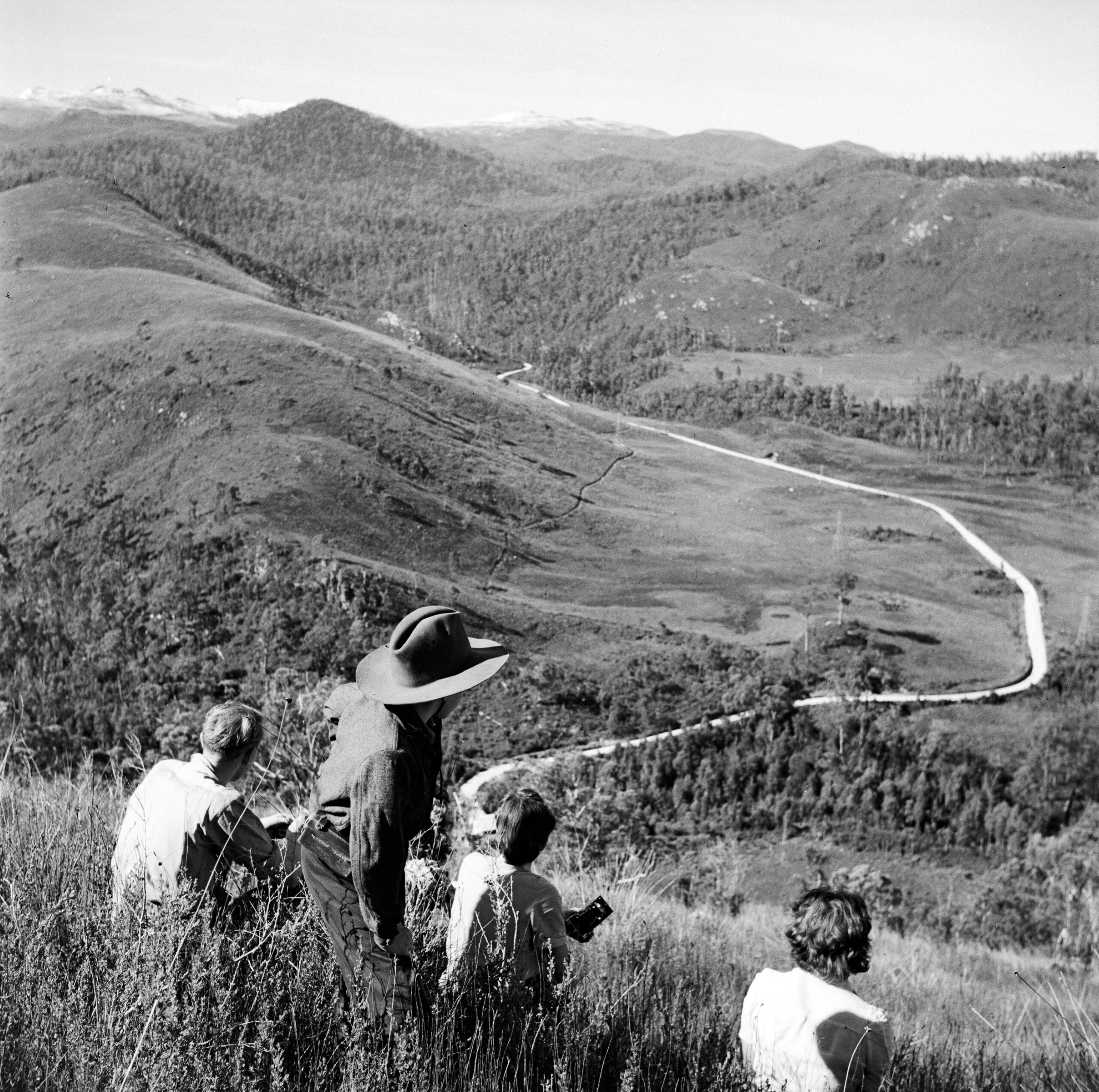
In the centre of Tasmania is an entertainment zone where the rules of decency are blurred. He-men brandishing ski poles, their bare nipples lasering the path to the Narcissus jetty, bleeding kids wondering if leeches are protected by UNESCO, beautiful, unwashed young couples smelling like a long-drop and swarms of flies experiencing the disappointment of tofu all help pickle the romance of the Overland Track between Dove Lake and Lake St Clair.
What about the original Overland Track? How did that compare as a mountainous hikeathon? Ye olde Trip Advisor is silent on that one. Snaking a path between the Nive River district and Mount Lyell, this Overland Track was Hobart’s nineteenth-century conduit to mining riches. The Linda Track, as it was otherwise known, bore a hint of James Calder’s 1840s trackwork but its heart was late-Victorian. Its comforts were too. No boardwalks, no signage, no tent platforms, no rangers, no chai-latte-tendering, guided private expeditionary services. Only a few bridges over major streams but plenty of opportunities to die of exposure. The history of the Linda Track is spiced with the same arguments about public safety as that of the present Overland Track—but at least it had Tom Moore as a guardian.
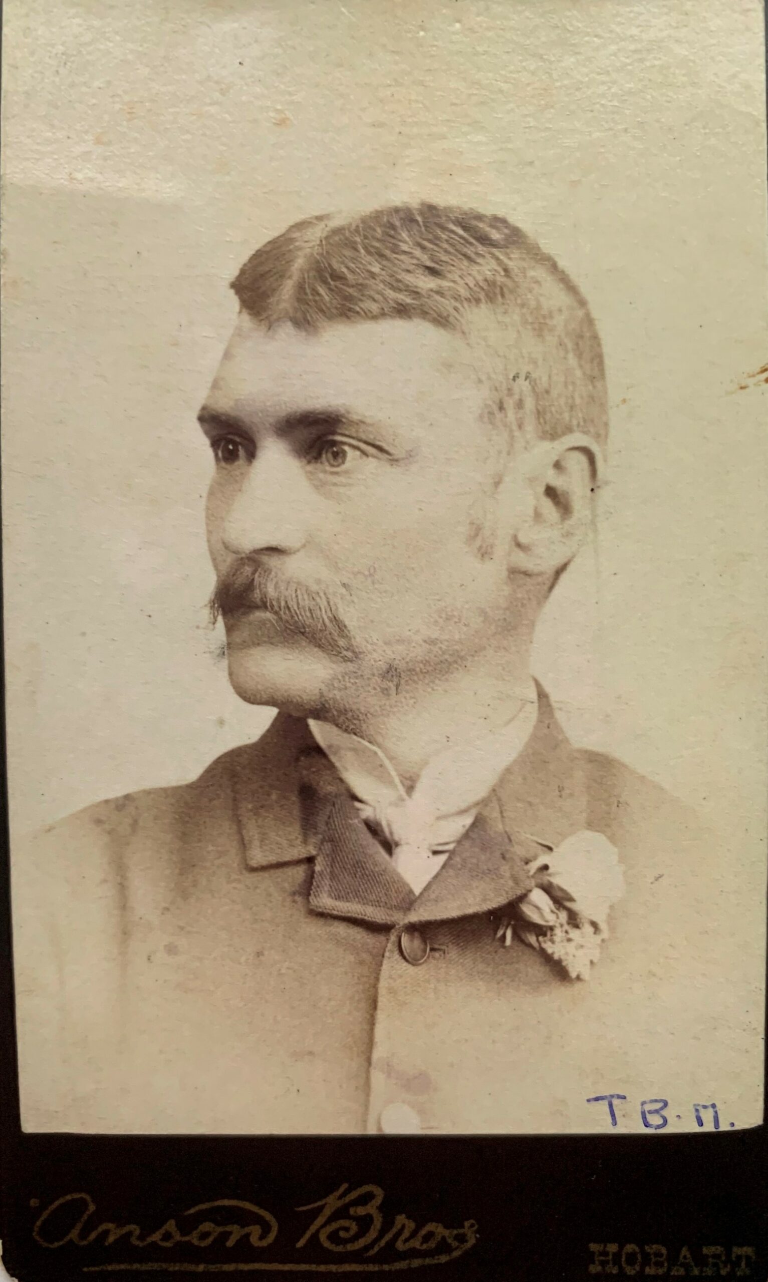
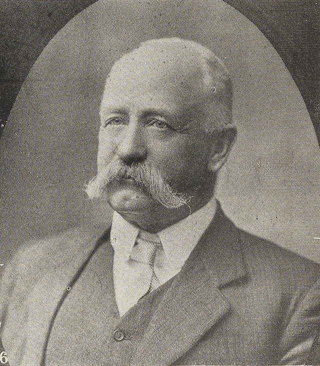
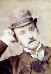
Tom Moore in middle age. Anson Brothers photo courtesy of Margaret Elliston.
Tom Moore and the Mount Lyell Iron Blow
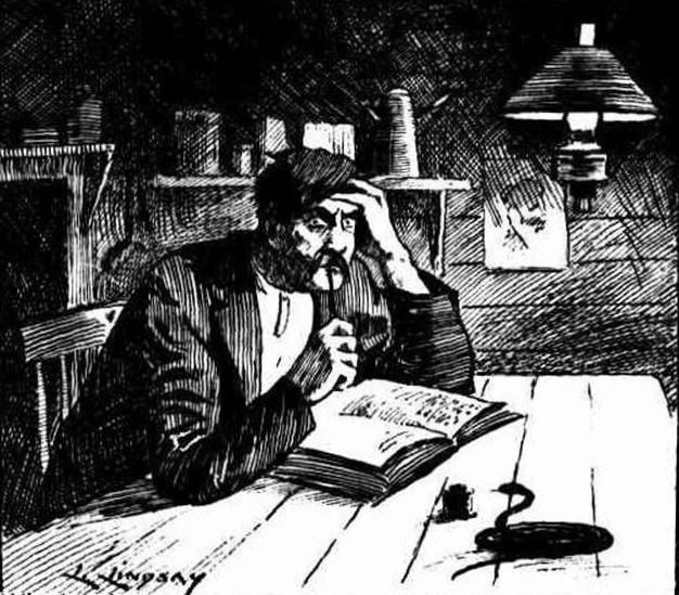
Anyone who has been a prisoner of their own tent will wonder at the curiosity, the ambition and the dedication of Thomas Bather Moore (1850–1919, aka Tom Moore or TB Moore). Each night in the bush, after retiring rain-sodden from the mud and a feed of echidna or wallaby, by candlelight in his tent Moore kept his immaculate diary, sometimes adding lines of philosophical verse, botanical notes or observations of comets and earth tremors. Moore’s solitary exploration work, endurance and scientific interests made him a legendary figure on Tasmania’s West Coast.
His chance to be known as a successful mineral prospector went begging—and this is really where the story of the Linda Track begins. In February 1883 Moore and a party of three including his brother Jim (JLA) Moore searched for an access route from Lake St Clair through to the West Coast. Near Mount Arrowsmith they established a supply depot. During the trip Moore named many features which are seen along the present-day Lyell Highway.[1] Entering the Linda Valley, Moore’s party climbed into the divide between Mounts Owen and Lyell, and while traversing what is now Philosophers Ridge discovered copper and iron pyrites. They also noticed the dark-coloured formation of boulders later known as the Iron Blow. According to Moore, another prospector and track-cutter, Tom Currie, found gold at or near the Iron Blow before being forced to withdraw from the field by illness.[2]
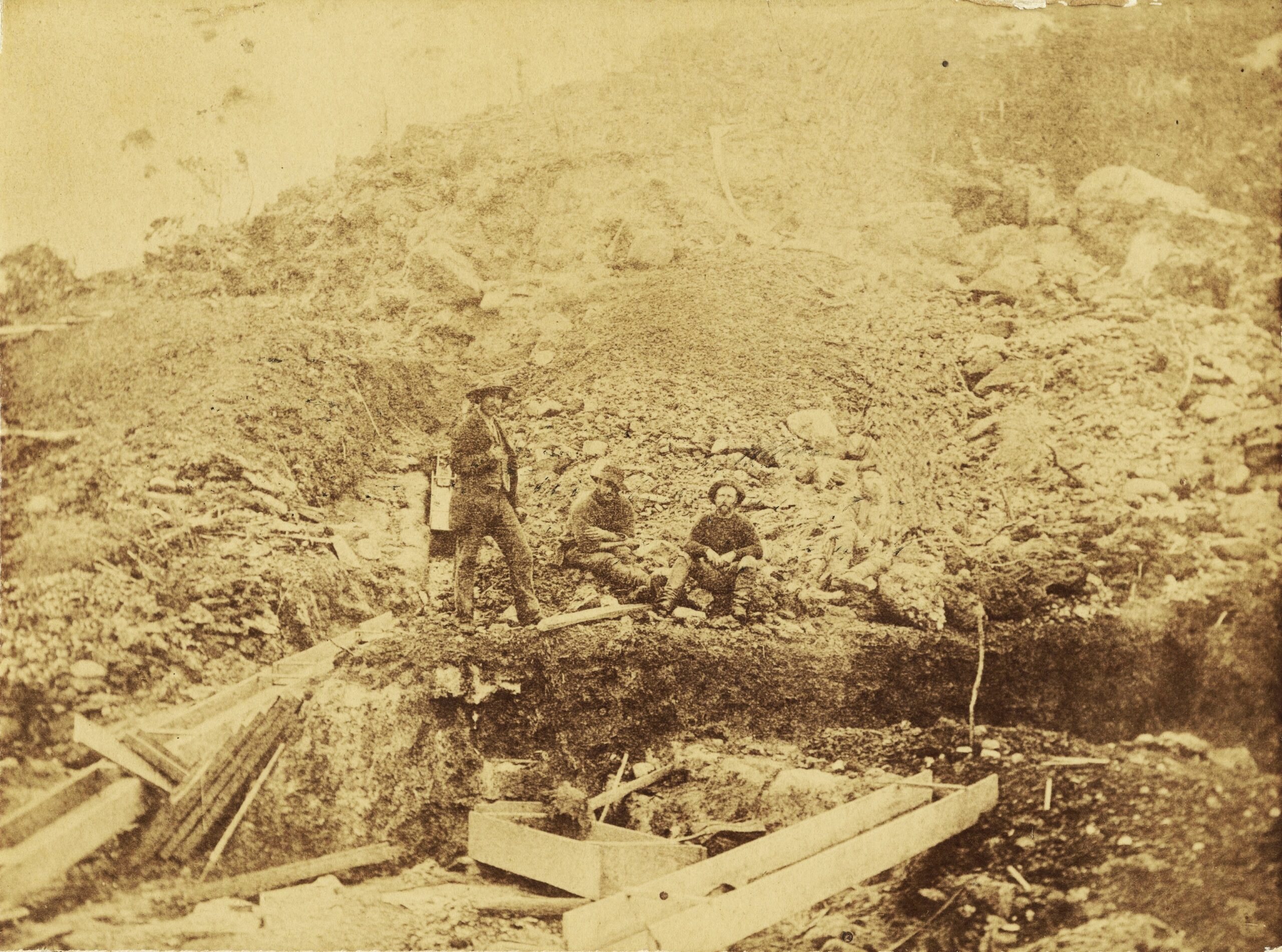
The Mount Lyell Iron Blow in 1884, presumably showing the three original lessees and one other. The fourth figure at right is almost ghostly. From NS3245/1/243 (TA).
Moore’s party was in no hurry to examine the Iron Blow. The appearance on the scene of ‘new chum’ prospectors, the brothers William and Michael McDonough, plus Steve Karlson, did not worry the Moores either, since they believed they only wanted to prospect the creeks for alluvial gold.
When Moore next visited the Iron Blow site, he was surprised to discover that the McDonoughs and Karlson had pegged a 50-acre prospecting area around the Iron Blow. Moore later conceded that underestimating the ‘new chums’ had cost him the chance to peg one of Tasmania’s greatest mineral treasures.[3] However, had Moore pegged the Iron Blow, it is possible that he would have fared no better than the prospectors who did. Their shares were surrendered for want of money, service providers and sharp investors being the beneficiaries of their plight.
Moore’s only consolation from his Iron Blow blunder was obtaining track-cutting work that served the discovery. The goldfield attracted a lot of attention in Hobart. In November 1885 he applied for the position of superintending overseer in the construction of the proposed track from the Marlborough property on the Nive Plains via the Collingwood Valley to the King River goldfield. Engineer of Roads William Duffy recommended Moore’s appointment because his knowledge of the country would be valuable in determining the route and securing the best line.[4] Moore accepted a salary of £4 per week, his duty being to mark a track in advance of the work gangs.[5] He showed the value of his experience immediately upon arrival at the Clarence River when he suggested a better way to supply the men and larger work gangs. He recommended setting up a store and employing a storekeeper. Pack-horses which conveyed supplies, Moore contended, could also be used in the haulage of logs and timber.[6]
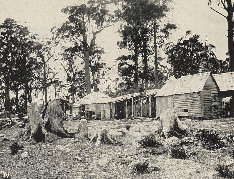
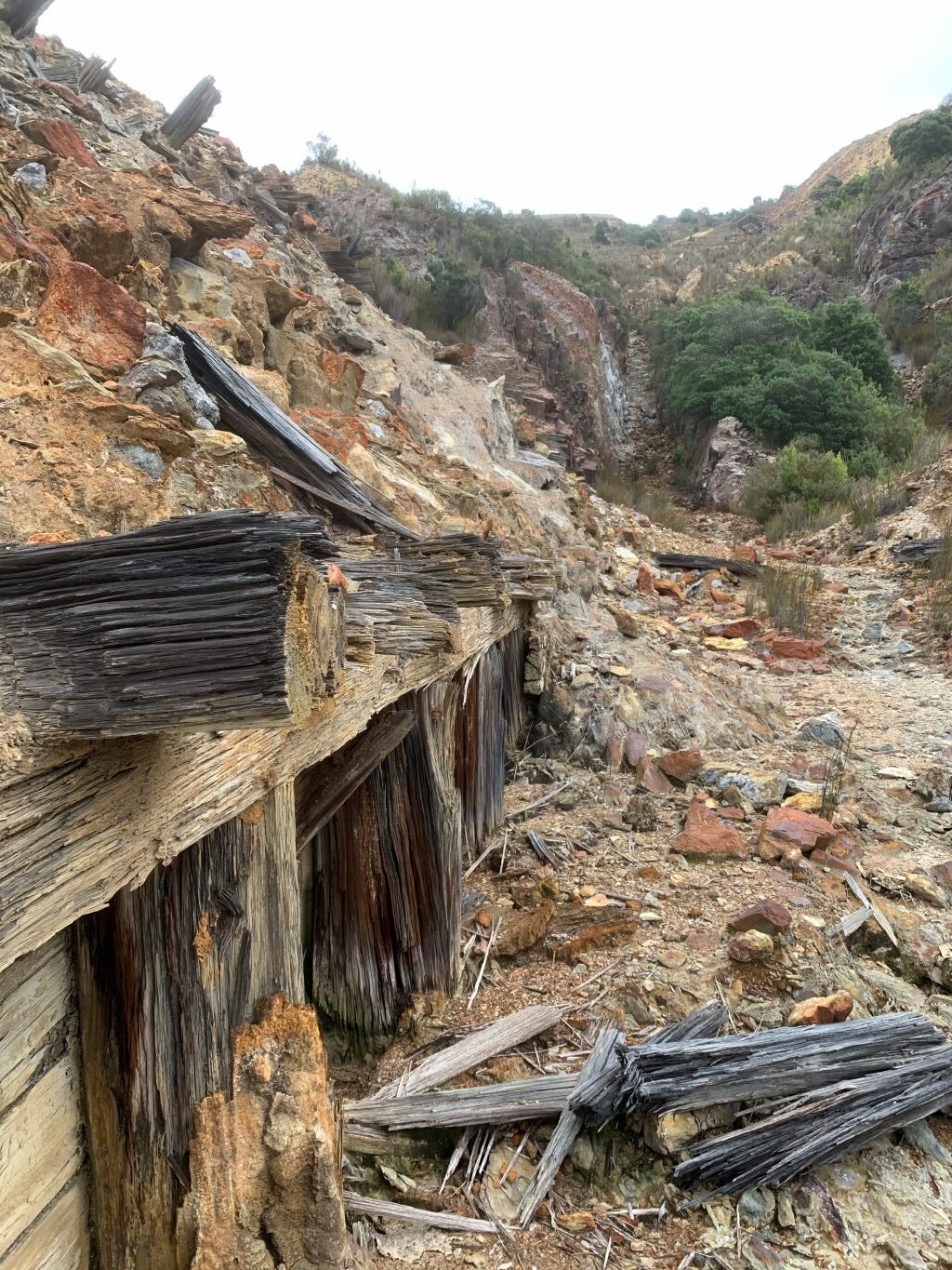
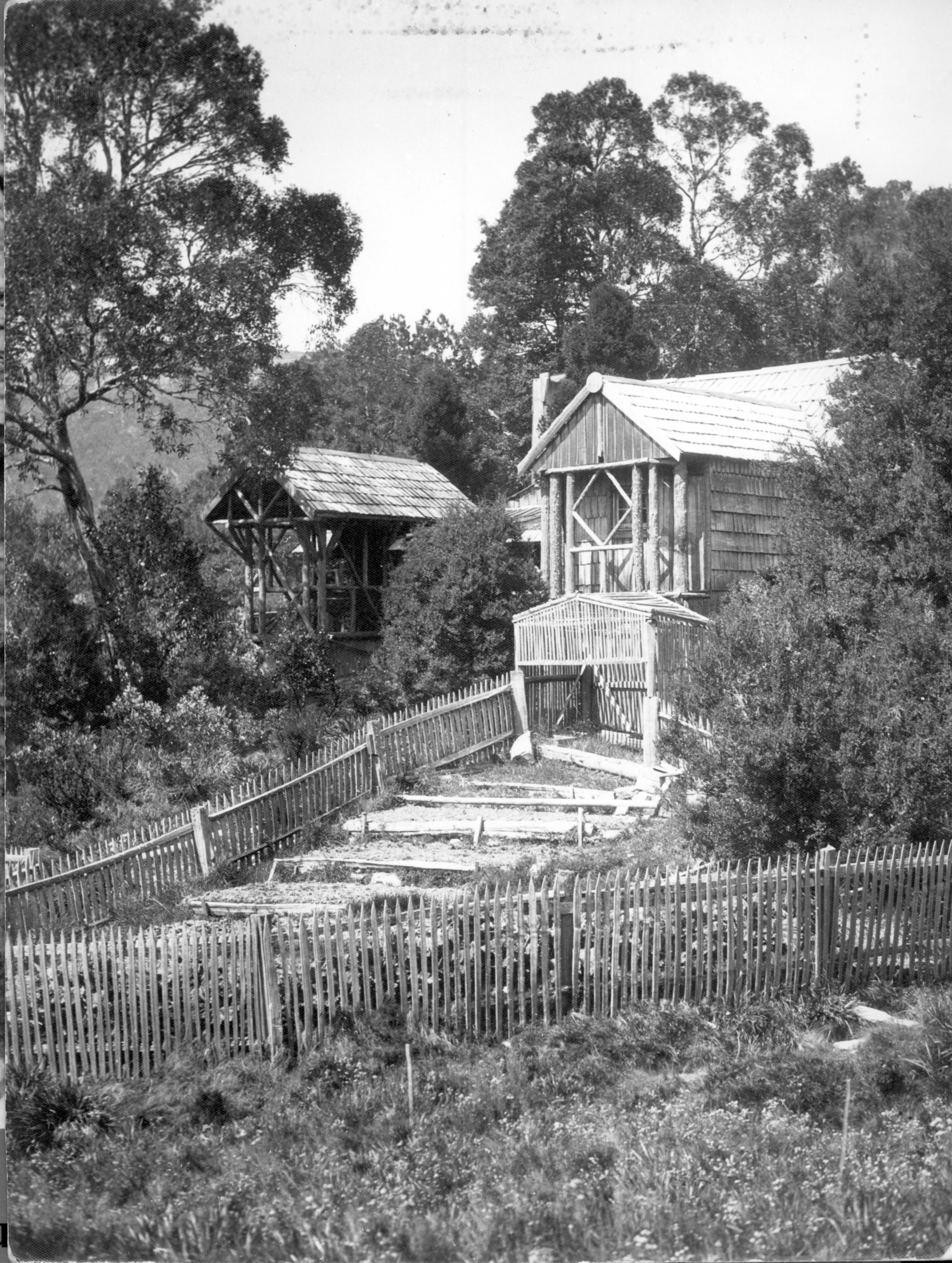
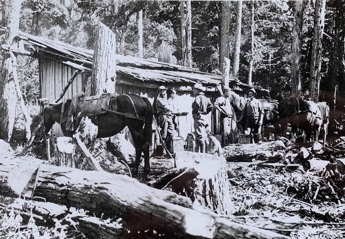
The 1915 iteration of the Iron Store complex of buildings. From the Tasmanian Mail, 21 January 1915, p.18.One of the gargantuan chimney butts at the Iron Store site today. Nic Haygarth photo.
Building the Iron Store
In his track work Moore chose to follow the general line of his 1883 route to Mount Lyell, settling on a route over Mount Arrowsmith.[7] He decided to erect the so-called Iron Store at King William Creek, on the site of his 1883 supply depot, the materials being packed in from Hobart. George Bray was appointed storekeeper. No additional hut was built simply for shelter at this time, although before the season closed Moore’s fellow overseer George Walch erected a slab stable to accommodate four horses.[8] Moore resented sharing command with Walch, whose management style frustrated him. He sought to undercut the other man by suggesting efficiencies and better methods of bridge building.[9]
Meanwhile, the track builders worked nine hours per day instead of the prescribed eight through the autumn, with the understanding that they were paid for days when the weather made it impossible to work. Moore proved a difficult man to control from head office. When ordered to stop work in April 1886, he refused, claiming that there was at least a further month of good weather ahead. Engineer of Roads William Duffy complained that ‘It will be impossible to work with a gentleman who refuses to obey such simple and necessary routine orders’.[10]
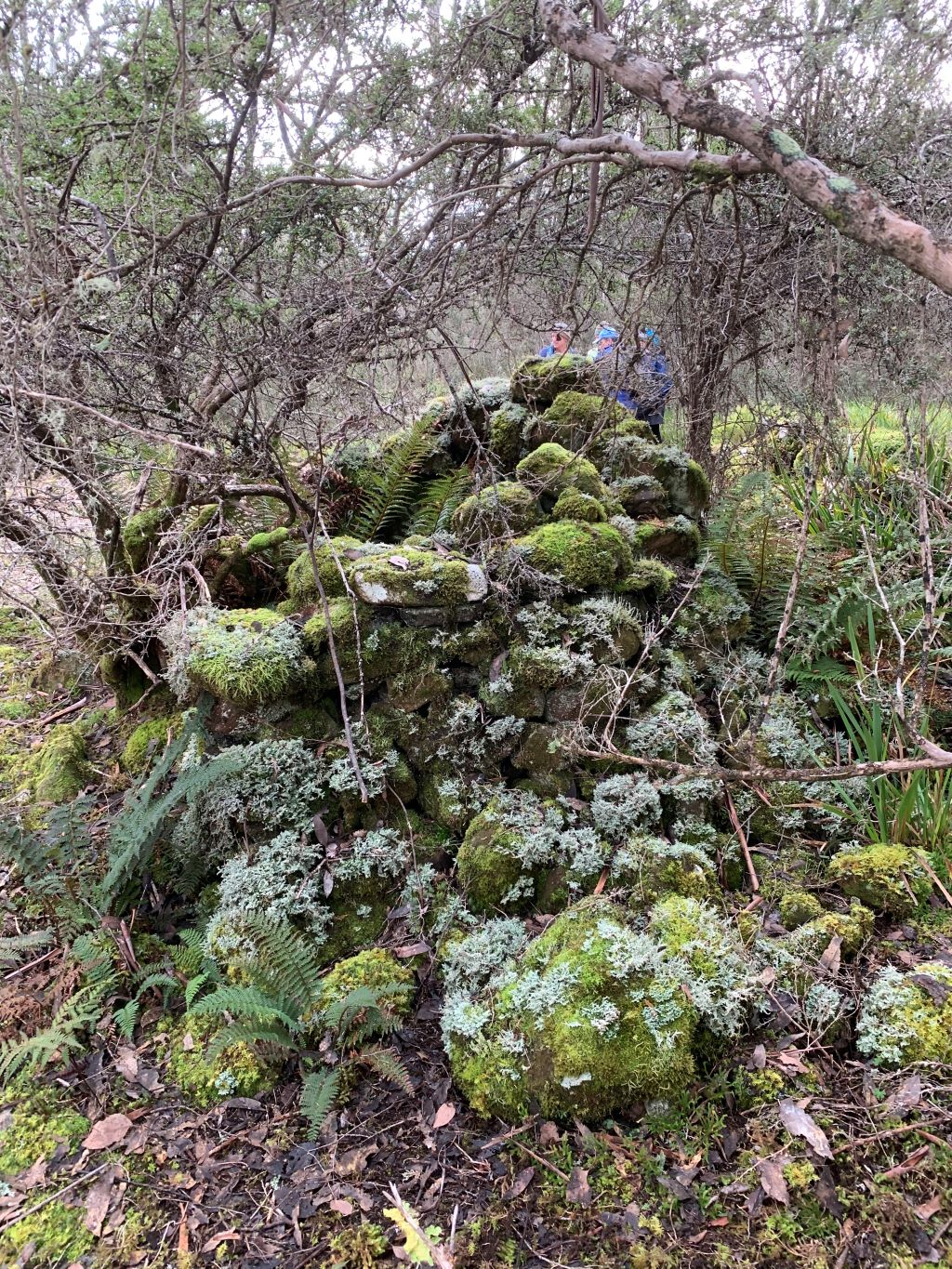
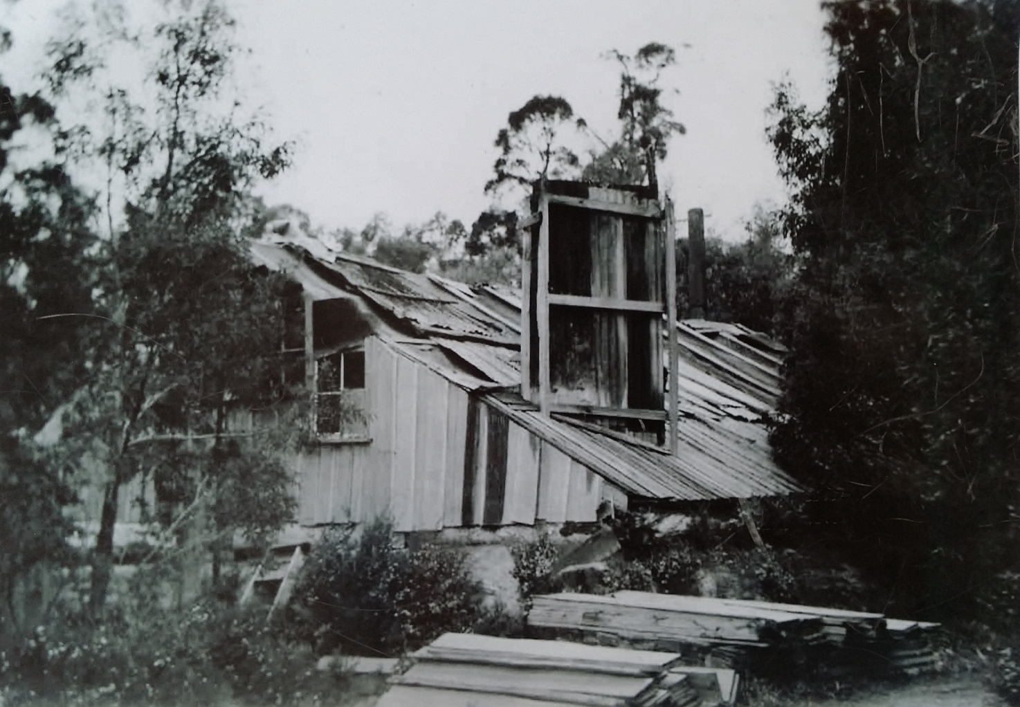
The Collingwood River Valley looking west, with Pigeon House Hill in the background at right, and Redan Hill, site of the first Wooden Store, in the foreground at left. Shane Pinner photo.Platform of the original Wooden Store today, beside the Linda Track at Redan Hill. Nic Haygarth photo.
Building the Wooden Store
Duffy got over it. The Lands Department needed Moore’s knowledge and drive. Moore requested the construction of another stores depot and shelter hut in the Collingwood Valley which would ‘eventually be useful as a halfway shelter hut’.[11] This hut was among the future needs he listed in his diary:
Stable at the Collingwood River 24 long 9 ft wide
6 ft being 12 front high & four stalls & chaff house 4 ft wide
(Palings 280 6 ft 200 5 ft) (4.6 wide)’
Huts required
From store depot [Iron Store]
Timber can be obtained without much difficulty.
West bank of Franklin R. 7 or 8 miles
West bank of Collingwood R 15 to 16 —
The Bubbs Victoria Pass 25 or 26 —
Huts to be built of six feet palings
18 feet long 10 feet wide 6 feet high
rafters 7 feet long, partition for sleeping 8 wide
with 4 feet chimney (store room 10 x 10 wide)
with door lock & key 2 ft sq window in gable with hinges & fastenings
While Moore’s plans for huts at the Franklin River and Bubbs Hill were shelved, the so-called Wooden Store and stable were built on the edge of the Linda Track at Redan Hill, overlooking the Collingwood River. These buildings lasted only a dozen years, gradually being destroyed by travellers, with the bunks pulled out, the door ripped off its hinges, the window broken and the timber chimney attacked with an axe.[13]
The Mount Lyell Iron Blow, battery, loading ramp and haulage, 1890s. James Huntley Clarke collection, NS6313/1/67 (TA).Loading facility and haulage at the Iron Blow today. Nic Haygarth photos.
Gold at Mount Lyell
In the winter of 1886 reports of fabulous gold assays circulated from the Mount Lyell Iron Blow. Inspector of Mines Gustav Thureau compared the Iron Blow to the famous gold deposits of Mount Morgan in Queensland, predicting a bonanza of ‘practically inexhaustible’ gold at Mount Lyell.[14]
The Iron Store showed its value as a shelter when excited investors despatched mining ‘experts’ to inspect Mount Lyell. In February 1887 Iron Storekeeper Bray took pity on one of them, Theophilus Jones, the itinerant, poverty-stricken journalist who was wending his way back to Hobart after being abandoned by the newspaper that sent him out. Jones reported gratefully that
Mr Bray, with that fine feeling, often displayed by those used to fatigue towards another on the march, insisted on my being seated to gain all the rest possible, whilst he went to the stream for a billy of water to make the ever refreshing tea, and when the infusion was ready helped us bountifully to his stores of tinned meat, etc.[15]
The Mount Lyell Gold Mining Company was registered in Launceston in 1888, echoing the momentous establishment of the Mount Bischoff Tin Mining Company there fifteen years earlier.[16] Unfortunately, Mount Lyell also had a much more complex ore body than Mount Bischoff, and was more isolated requiring more capital investment than the Launceston company could raise.
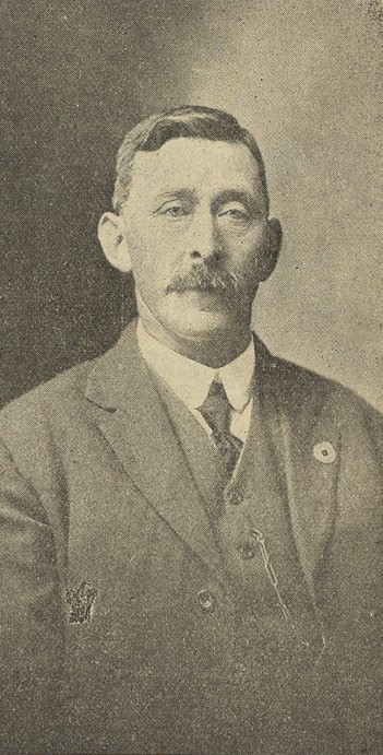
Alfred Taylor, from the Tasmanian Mail, 11 December 1919, p.20.
The trail runner for the telegraph line
The present Overland Track measures 65 km from Dove Lake to Narcissus, with four intervening huts. The original Overland Track was 98 km from Nive Plains to Mount Lyell with initially just two huts. 1890s telegraph lineman Alfred Taylor would challenge modern ultra athletes skipping from Cradle to St Clair in a day. Broken culverts and fallen trees forbade horse travel along the Linda Track in the early years. Thus Taylor often hotfooted 138 km in three days from the Clarence River to Strahan. The ravenous tiger cats at the Iron Store may have prompted Taylor to sprint 58 km on the first day to avoid it by reaching the Wooden Store. A swig from the brandy flask would help him sleep through the cold (in winter) and the mosquitoes (in summer). Next stop was the Queen River Hotel, 45 km further on, where a jug of beer awaited him. Strahan, the end of the journey, was another 35 km beyond that. If a steamer was in port, Taylor would take the 6.5-day voyage to Hobart, otherwise retrace his steps to his home at Dee River.
The telegraph line from the Iron Store to Strahan, connecting Hobart to the western seaboard, was the work of brothers John, James and David Pearce in 1891–92. Taylor supervised their contract work and then continued as lineman. He described a daily menu of bully beef, bacon, wombat and honey stolen from hives in the myrtle forest; and a daily routine of being soaked to the skin and camped knee-deep in mud among swarming tiger cats. Leeches didn’t seem to bother him.[17]
Taylor the human snow plough
The annual Cradle Mountain Run now pushes marathoners the full 80 km from Cradle to the southern end of Lake St Clair. How would they have fared on the Linda Track without duckboards, thermals and satellite phones in the great snows of 1894 and 1900? Taylor turned yeti in these conditions. On Mount Arrowsmith he ploughed through snow drifts up to 5 m deep. Sometimes 60 cm or more of snow were frozen hard on the top of each tree used as a telegraph pole. Bashing the base of the tree to unfreeze it, he would sometimes receive the bulk of the snow down the front of his shirt, giving him a counterweight to the icicles hanging from his nose and moustache.[18]
Taylor got no help from fellow travellers. By 1896 the only way to keep the rain out of the Wooden Store was to stuff clothes in the open window hole.[19] Two years later ‘the old barn with chimney and door down and windows out’ was replaced by a new iron ‘Wooden’ Store, stable and cattle yard built much closer to the Collingwood River.[20] However, the location proved just as boggy as the old one, with mud several feet thick being reported after the ground was churned up by horse traffic.[21] The mosquitoes there were reportedly ‘intolerable’.[22]
Garland bewitched by the serpent at the Iron Store From Free Lance, 14 May 1896, p.14.Sydney Page, Weekly Courier, 29 April 1920, p.23.
Sydney Page’s coach service
In 1896 a writer calling himself Arthur Conway penned a screed about a storekeeper losing his sanity ‘in the house of the ungodly’, a tin hut on the Linda Track known as the Iron Store. In the solitude, with only the tigers and devils for company, Hugh Garland succumbed to the snake.[23]
The serpent might have been trampled by the hooves of the coach service in the following year.[24] The Mount Lyell Copper Mine was then the subject of Australia’s last national mining boom of the nineteenth century.[25] Foot traffic on the improved track increased to the extent that Sydney Page, son of the late stage-coach entrepreneur Samuel Page, tried a coach and horse service between the rail head at Macquarie Plains near Glenora and Gormanston, the miners’ town for the Iron Blow. The stage-coach section had stopovers at the Jenkins residence, Dee River, and the Lake St Clair Accommodation House, before travellers reached the coach terminus of the Iron Store. On day four they set off on horseback across Mount Arrowsmith, overnighting at the Wooden Store beyond the Collingwood River.[26]
The service didn’t last long, because while Page’s nags were kicking over the gibbers northern interests were waging a ‘railway war’ to send a line westward. In 1899 the Emu Bay Railway Company laid rails into Zeehan, completing a connection with Mount Lyell. The Linda Track remained Hobart’s overland route to the west until in the late 1920s—about the time Ron Smith conceived the idea of the present Overland Track—the Lyell Highway obliterated much of it. Further tales of the original Overland Track will follow.
[1] These included Artist Hill, in keeping with nearby Painters Plain, and Junction Peak, at the junction of the Franklin and Collingwood Rivers. In the Collingwood River Valley Moore named several features (Redan Hill, Raglan Range, Scarlett Hill, plus the Inkerman, Balaclava and Cardigan Rivers) to complement Charles Gould’s Crimean War reference of the Alma River. Further west he christened Nelson River after his godson Nelson Brent, the Princess River in keeping with the King and Queen Rivers and Thureau Hills after Inspector of Mines Gustav Thureau (TB Moore diary, 1974–87 compilation, ZM5618 [TMAG]).
[2] TB Moore diary, 1974–87 compilation, ZM5618 (TMAG); TB Moore, ‘In the early days of Mount Lyell: the first discovery of gold on the Mount’, Mount Lyell Standard and Strahan Gazette, 5 December 1896, p.4; TB Moore, ‘Discovery of Mount Lyell Mine’, Zeehan and Dundas Herald, 12 May 1919, p.1.
[4] William Duffy, notes written on the back of Moore’s application, PWD18/1/966 (TA).
[5] TB Moore to the Minister of Lands, 3 December 1885, PWD18/1/966 (TA).
[6] TB Moore to the Minister of Lands, 21 January 1886, PWD18/1/966 (TA).
[7] TB Moore diary, 1874–87 compilation, ZM5618 (TMAG).
[8] Overseer George Walch to the Director of Public Works, 1 May 1886, PWD18/1/966 (TA).
[9] TB Moore diary entry, 15 March 1886, ZM5620 (TMAG); Moore to Minister of Lands, 26 March 1886.
[10] William Duffy, Engineer of Roads, memo for Overseer George Walch, 28 April 1886; William Duffy, Engineer of Roads, memo dated 19 May 1886, PWD18/1/966 (TA).
[11] TB Moore to William Duffy, Engineer of Roads, from Iron Store, 3 March 1886, PWD18/1/966 (TA).
Mining in a scenic reserve? A fur farm as well? How about damming a protected lake to generate power? Bring it all on. During its first 25 years the Cradle Mountain–Lake St Clair National Park was a free-for all.
The national park might have been sparked by a sermon on Cradle Mount but its implementation was more like a meditation on patience. In the 1920s economy reigned over ecology in Tasmania. With the state considered an economic basket case, government had little appetite for funding national parks or for standing in the way of resource exploitation. The Scenery Preservation Board which nominally managed the park had only advisory powers and was, as Gerard Castles suggested, ‘handcuffed’ to this development ethos.[1] Voluntary park administrators attacked their task with a passion. However, their efforts were clouded by conflicts of ideology and pecuniary interest. The first two decades of park management were beset with challenges from the mining, fur and timber industries and the government mantra of hydro-industrialisation. Even the local experts employed to build, maintain and oversee park infrastructure and guide tourists were ‘exploiters’—fur hunters and mineral prospectors. The idea of a road from Cradle Mountain to Lake St Clair was entertained on the ‘bigger, better and more accessible’ social justice principle that has been used time and time again in Tasmania to justify development of natural assets. What a mess!
Waldheim in the Weindorfer era. Fred Smithies photo, courtesy of Margaret Carrington.
Getting to Cradle Mountain in 1924, the Citroen-Kegresse prototype, which Weindorfer called the ‘platypus motor’. Stephen Spurling III photo.
Origins of the park
The Cradle Mountain–Lake St Clair National Park had three starting points: Cradle Mountain, the Pelion/Du Cane region, and Lake St Clair. At Cradle Valley Gustav and Kate Weindorfer established a tourist resort called Waldhiem in 1912. The story of how they built it and almost no-one came has been told a thousand times. In the Pelion/Du Cane region hunter/prospector Paddy Hartnett had a network of huts, some of which doubled as staging posts for his guided tours as far south as Lake St Clair. Three industrial-size skin drying sheds which stood near Pelion Gap, at Kia Ora Creek and in the Du Cane Gap give some idea of the scale of hunting operations before and after World War One (1914–18). Hartnett’s Du Cane Hut remains today. Lake St Clair had been visited fairly regularly by Europeans for almost a century. It was effectively reserved in 1885 when a half-mile-wide zone around its shores was withdrawn from selection. The Pearce brothers built a government accommodation house, boat house and horse paddock at Cynthia Bay 1894–95 but the buildings were destroyed by fire in 1916.
Paddy Hartnett’s massive skin shed near Kia Ora Creek, 1913. Stephen Spurling III photo courtesy of Stephen Hiller.
When Gustav Weindorfer declared famously that ‘this should be a park for the people for all time’, he meant only the Cradle Mountain–Barn Bluff area in which he later operated. Other park proponents, including Director of the Tasmanian Government Tourist and Information Bureau ET Emmett, and bushwalker photographers Fred Smithies, Ray McClinton and HJ King, were familiar with a much greater area. They wanted to include the swathe of land from Dove Lake to Lake St Clair, making an area about six times the size of the Mount Field National Park.
The Scenery Preservation Act (1915), under which the Freycinet Scenic Reserve and National Park (Mount Field National Park) were gazetted in 1916, forbade the lighting of fires, cutting of timber, shooting of guns, removal or killing of birds and native or imported game and damage to scenic or historic features on reserved land. The Act therefore effectively forbade hunting but it did not expressly forbid mining, even though mining always included the lighting of fires and cutting of timber. Parts of the proposed national park area were already logged, grazed, hunted and mined, and to allay fears of these primary industries being locked out of a proclaimed reserve, in 1921 the Act was amended to allow exemptions from the provisions of the original Act.[2]
Stephen Spurling III photo, from file AB948/1/225, Tasmanian Archives.
The Pelion oil field
World War One (1914–18) had created anxiety about resource security in Australia and precipitated revolution and civil war in Russia. Outcomes for Tasmania included the search for shale oil reserves and a boom in the Tasmanian fur industry, with brush possum skins helping to make up for the loss of Russian fur reserves. While a lantern lecture campaign promoted the idea of a Cradle Mountain national park in 1921, about 80,000 acres of the land in question was under exploration lease in the search for shale oil (‘inspissated asphalite’). The Adelaide Oil Exploration Company used a Spurling photo to push the idea that Mount Pelion West was a motor oil bonanza. Its proponents assured would-be investors that its lease contained ‘the greatest potential amount of wealth hitherto controlled by any one concern in the British Empire, and, probably, in the whole world, outside the United States of America’. Faith might be able to move mountains, but the government geologist assured them it couldn’t put oil in these mountains. The only lasting impact of oil exploration was the Horse Track south from Waldheim, which was marked to enable pack horses to supply coal/oil operations at Lake Will.
Gustav Weindorfer hunting at Lake Lilla with his dog Flock, 1922. Stephen Spurling III photo courtesy of Stephen Hiller.
The Cradle Mountain fur farm
The Cradle Mountain and Lake St Clair Scenic Reserves were gazetted under the amended Act in 1922 but at first neither was a fauna sanctuary under the Animals and Birds Protection Act (1919). With the surge in hunting it was inevitable that fur farming on the Canadian model was proposed for Tasmania. The Fur Farming Encouragement Act (1924) reserved 30,000 acres at Cradle Mountain for a fur farm, but before local hunters could protest, in 1925 this area was dismissed as unsuitable by two of the scheme’s proponents, Melbourne skin buyers who, extraordinarily, believed that ‘furs grown at a high altitude have not the good texture of those grown on the low lying country’.[3] Nobody seems to have counselled Tasmanian hunters that high country furs were inferior. Working at Lake St Clair in the winter season of 1925, Bert Nichols reportedly made the small fortune of £500, his possum skins fetching 17 shillings 11 pence and his wallaby skins more than 12 shillings each at the Sheffield Skin Sale.[4] This was at a time when the average annual wage for a farm worker was about £110 to £125.[5]
Two subsidiary management boards
Two subsidiary bodies were appointed to advise the Scenery Preservation Board on matters relating to the two adjoining scenic reserves. One, the National Park Board, already helped manage the Mount Field National Park. Chaired by botanist Leonard Rodway, with Tasmanian Museum director Clive Lord as its secretary, it now added the Lake St Clair Scenic Reserve to its purview. The other body, which administered the Cradle Mountain Scenic Reserve, was created from nominated representatives of interested organisations and municipal councils plus several people who had campaigned for the reserve’s creation.[6] Ron Smith (Cradle Mountain Reserve Board secretary from 1930) and Fred Smithies became standard bearers for the 68,000-acre Cradle Mountain Reserve, but their simultaneous ownership of land at Cradle Valley inevitably led to a conflict-of-interest situation.
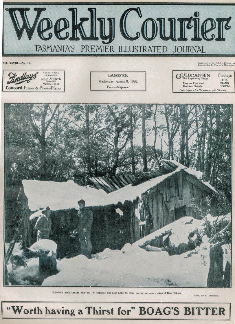
Fred Smithies’ photo of ‘a trapper’s hut near Lake St Clair’, Weekly Courier, 8 August 1928. Courtesy of Libraries Tasmania.
During 1927 the Cradle Mountain and Lake St Clair Scenic Reserves were gazetted as fauna sanctuaries.[7] Two months later the hunter/prospector Dick Nichols was nabbed for poaching at a hunting hut in the Cuvier Valley. His brother Bert was probably around somewhere too but escaped detection, and it became clear that they had a network of hunting huts around Lake St Clair and in the Cuvier Valley.[8] Fred Smithies, a member of the CMRB, was used to sleeping among the drying pelts in Bert Nichols’ Marion Creek Hut.[9] In the winter of 1928 he took a lovely photo of it under snow and this poacher’s hut in a fauna sanctuary made the front cover of the Weekly Courier newspaper![10] Nichols later duplicated the hut for the use of Overland Track walkers.
The Overland Track
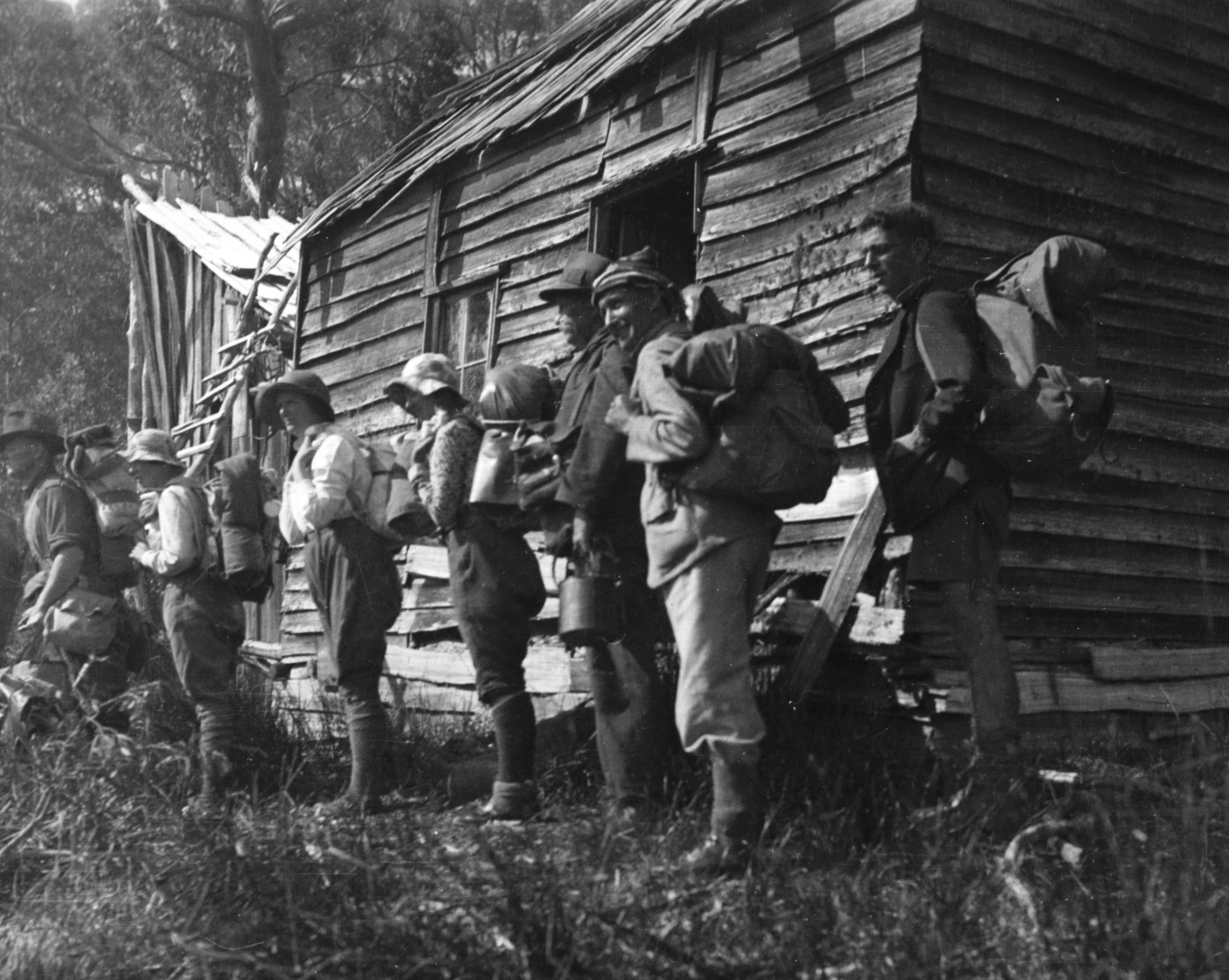
The idea of threading a track through the two reserves to unite them seems to have started with Ron Smith, who in 1928 envisaged an ‘overland track’ connecting Cradle Mountain and Lake St Clair, including a motor boat service on the lake.[11] Sections of track that could be linked already existed, including that marked by Weindorfer from Waldheim to Lake Will (the basis of the Horse Track), the Mole Creek Track between Pelion Plain and Pine Forest Moor, and hunters’ tracks from Pelion Plain through to Lake St Clair and the Cuvier Valley. Paddy Hartnett offered to cut the Overland Track for £440, but Bert Nichols did it for only £15.[12] He connected up sections of track and cleared others south of Pelion Plain to form the Overland Track in 1931.[13] Mining, hunting and tourism huts like Old Pelion, Lake Windermere and DuCane were adopted as staging posts along the track.
In 1934 Fergy established this dining room and associated huts at Cynthia Bay, Lake St Clair. Norton Harvey photo.
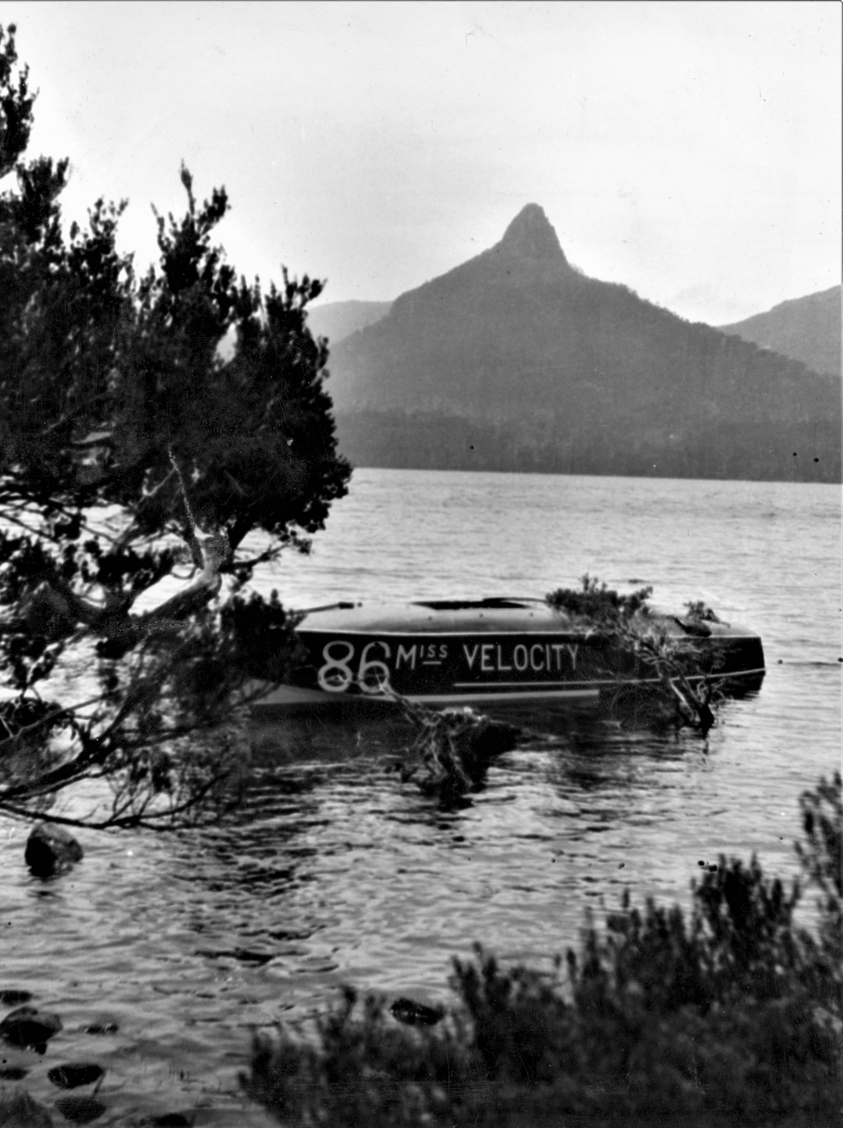
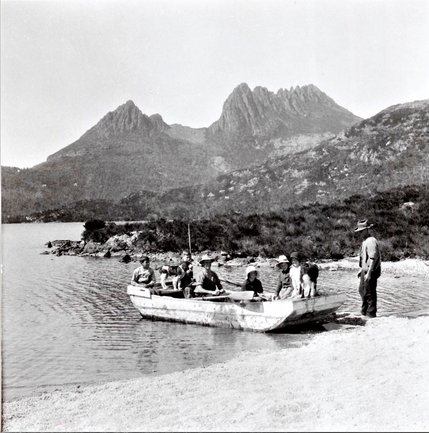
Although the official Overland Track went through the Cuvier Valley, it soon became standard procedure to cross Lake St Clair instead on tourist operator Albert ‘Fergy’ Fergusson’s motorboat. During the Great Depression Miss Velocity was an integral part of Bert Nichols’ guided tours on the Overland Track. Fergy’s tourist camp of sixteen tent-huts with earthen floors and a communal rustic dining room rivalled Weindorfer’s set-up at Cradle Valley.[14] He employed a housekeeper and owned a ‘frightful old bus’ with sawn-off cane kitchen chairs for seats, with which he drove walkers out to the Lyell Highway at Derwent Bridge.[15]
A 1929 Bert Nichols party at Windermere Hut. Marjorie Smith photo courtesy of the late Ian Smith.
Fergy’s racing boat Miss Velocity at rest in front of Mount Ida, Lake St Clair, 1929. Marjorie Smith photo courtesy of Ian Smith.
The death and wake of Gustav Weindorfer
Gustav Weindorfer died of cardiac arrest in Cradle Valley in May 1932, apparently in the act of trying to start his Indian motorcycle.[16] His name was already inscribed on his wife Kate’s headstone at Don in anticipation of him joining her there but a group of his friends arranged his interment in front of Waldheim.[17] Ironically, despite his love of the place, for years Weindorfer had been trying to sell and leave Waldheim.[18] Now he was stuck there!
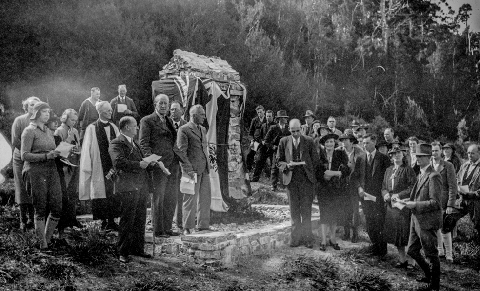
The ceremony to unveil the memorial to Gustav Weindorfer at Waldheim, 1938, with Ron Smith in the foreground at right. Fred Smithies photo courtesy of Margaret Carrington.
The Austrian secular tradition of remembering departed loved ones was adopted at Weindorfer’s grave after his sister Rosa Moritsch sent a bunch of flowers and four small candles from his native land. These were placed on his grave on New Year’s Day 1933. For several decades Weindorfer’s good friend Ron Smith organised the annual New Year’s Day ceremony. The annual commemoration of Weindorfer’s life has assumed possibly unparalleled longevity among Australian public figures.
The work of the Connells
First Bert Nichols and then Barrington farmers Lionel and Maggie Connell looked after Waldheim before a syndicate of Weindorfer’s Launceston friends (George Perrin, Charlie Monds, Karl Stackhouse and Fred Smithies) bought the chalet from his estate.[19] They asked the Connells to stay on as managers. Lionel Connell had been snaring around Cradle Mountain for two decades and knew the country well. The Connells, with six sons and daughters to help them, set about making Waldheim financially viable by extending the building and improving access to it.
Lionel Connell loading up Weindorfer’s punt on Dove Lake, 1936. Ron Smith photo courtesy of Charles Smith.
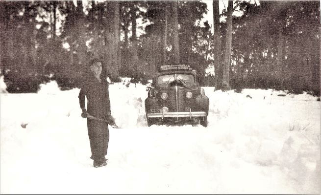
Os Connell digging out his family’s Sheffield–Cradle Mountain Passenger Service, 1943. Photo courtesy of Es Connell.
In the late 1930s the Connells had a tourism package for the Northern Reserve that far exceeded that of Gustav Weindorfer, ferrying visitors to and from Waldheim in their car, accommodating visitors, feeding them with produce from the farm at Barrington, guiding them around Cradle Mountain and even guiding them on pack-horse tours on the Overland Track.
Fergy’s other tub: early rangers
Ex-hunter and Overland Track guide Bert Nichols is said to have removed Overland Track markers when they were not needed in order to snare undetected in the fauna sanctuary. Nichols did other infrastructure work and was appointed ranger for two months in 1935. However, when the time came to appoint a permanent ranger the known poacher was not considered for the job.
A Lionel Connell hunting hut built with Dick Nichols still stood south of Lake Rodway as a reminder of the former’s past. Yet Connell was considered fit for a permanent posting as ranger.[20] The Connell family demonstrated great enterprise in their work at Cradle but conflict between Lionel’s roles of privately-employed tourism operator and government-employed ranger at the same location were soon obvious. To compound the issue, Connell managed Waldheim for Smithies and Karl Stackhouse. These men, as members of the CMRB, also effectively employed him as a ranger. CMRB Secretary Smith also had a family tie with the Connells.
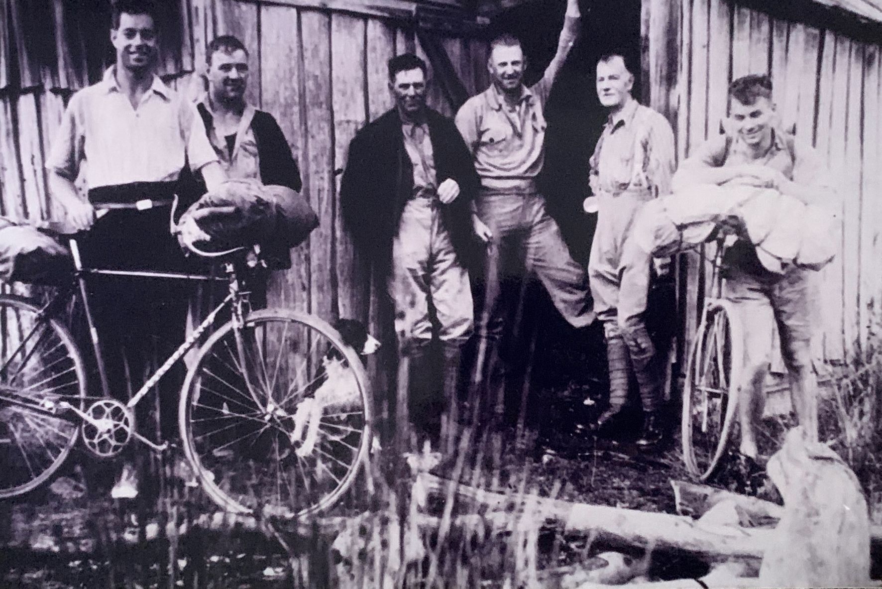
Cyclists arriving at Old Pelion Hut, 1936. With them (left to right) are (possibly) Os Connell, Lionel Connell, Mount Field ranger HE Belcher and Director of the Government Tourist Bureau, ET Emmett. Photo courtesy of Es Connell.
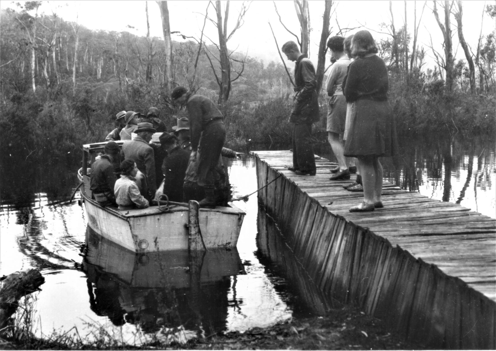
Fergy overloading Miss Velocity’s more mundane replacement at Narcissus Landing, 1940. Ron Smith photo courtesy of Charles Smith.
The other remarkable early ranger was Fergy who, like Lionel Connell, combined the job with that of tourism operator. His toughest journey was not on the lake but in an upside-down bath. While building the original Pine Valley Hut, the Lake St Clair ranger lugged an iron tub to it about 10 km from Narcissus Landing by balancing it upside down on his shoulders and head, his forehead reputedly having been reinforced to mend a war wound (his World War One record suggests only that he suffered from shell shock and deafness). Stripping off in the heat, his curses echoing inside the bath, he was stark naked when he ran into a party of bushwalkers.
Extension of eastern and western reserve boundaries 1935 and 1939
The extension of fauna sanctuary boundaries to natural features was done with the intention of negating claims by hunters that they weren’t sure where the boundaries were. Tommy McCoy seems to have known. His Lake Ayr Hut was cheekily perched within sight of the reserve boundary. Reactions to it showed the distinction between the old-style conservationists in the park administration and the new ones of the bushwalking community. Cradle Mountain Reserve Board Secretary Ron Smith, a former possum shooter, respectfully left payment of threepence for a candle he removed from McCoy’s camp.[21] Hobart hikers, on the other hand, became conservation activists, puncturing McCoy’s canned food with a geological pick when they found his hut in 1948.[22] McCoy, like fellow snarers Paddy Hartnett, Bert Nichols and Lionel Connell before him, embraced the opportunities offered by tourism, building and repairing Overland Track huts. He was proprietor of Waldheim Chalet when he died in 1952.
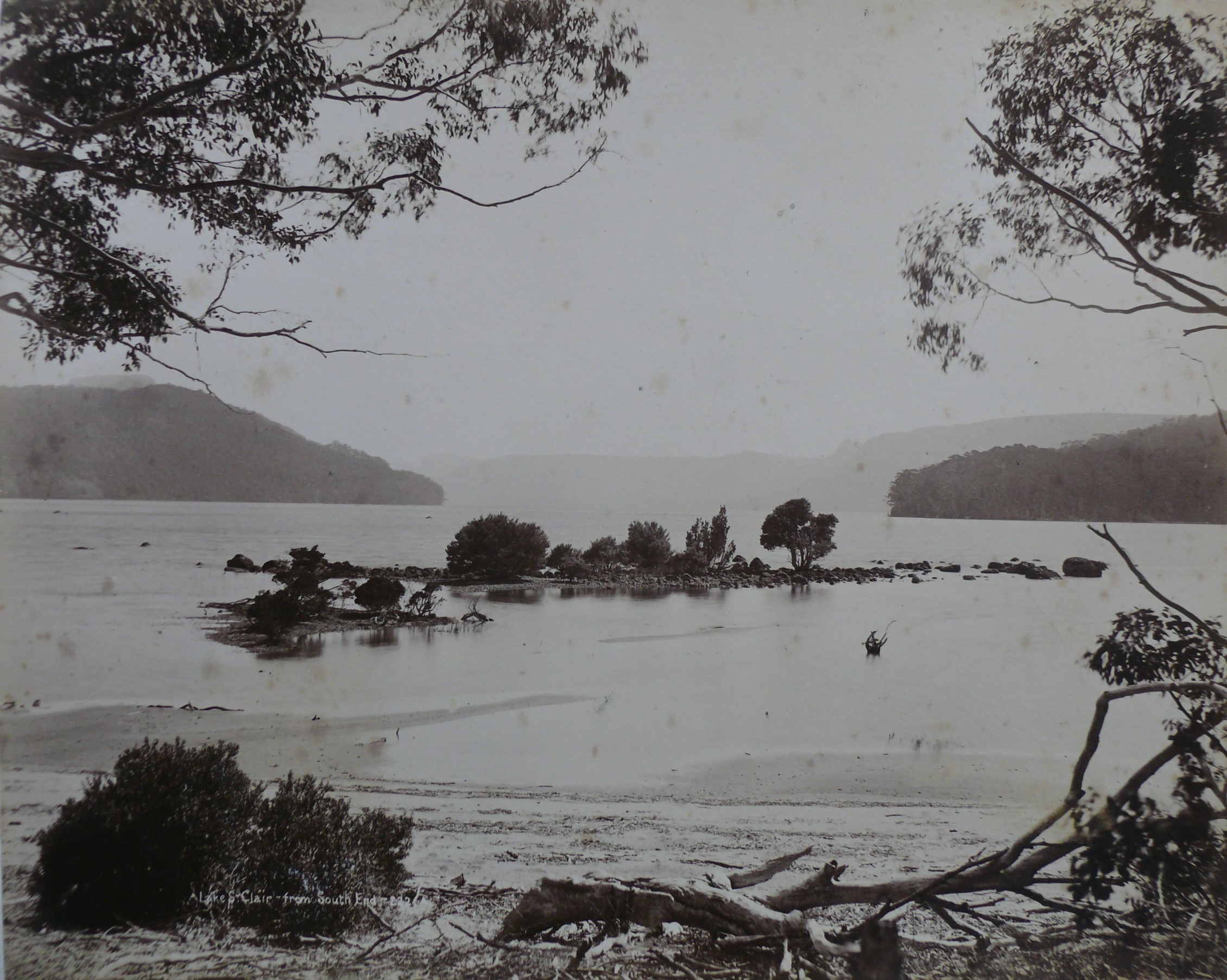
Some of JW Beattie’s islands, southern end of Lake St Clair. Beattie photo, courtesy of Alma McKay.
Damming Lake St Clair 1937
The Art Deco Pump-house Hotel which juts into southern Lake St Clair, as if walking the plank for its crimes, is a symbol of gradually changing values. In 1922, in a joint lecture about ‘preserving’ the tract of land south from Cradle Mountain, Ray McClinton and Fred Smithies deplored the ‘firestick of the destroyer’ and the ‘ravages of the trapper’ but spruiked the hydro-electric potential of the region’s lakes.[23] Fifteen years later the naivety of this position became apparent when the Hydro-Electric Department dammed the Derwent River as part of the Tarraleah Power Scheme. After assuring the National Park Board that Lake St Clair would be unaffected, it raised the lake’s water level by more than a metre, sinking the golden moraine sand (the Frankland Beaches) and the accompanying islands once painted by Piguenit and photographed by Beattie.[24] A fringe of dead trees around the lake’s edge now greeted visitors. When photographers Stephen Spurling III and Frank Hurley joined the National Park Board in attacking the Hydro, Minister for Lands and Works Major TH Davies sprang to the institution’s defence, describing the damage as ‘unavoidable’.[25] This was a taste of what was to come at Cataract Gorge, Lake Pedder, the Pieman River and the Lower Gordon River.
Excision of the Wolfram Mine
With rearmament taking place in Europe in 1938, the raised price of tungsten (wolfram), used for strengthening steel, prompted an application to reopen the (Mount Oakleigh) Wolfram Mine, which was then included in the Cradle Mountain Reserve. CMRB Secretary Ron Smith penned the board’s opposition to the proposal, stating that no payable lode was likely to be found and that a successful application would set a bad precedent in terms of mining the reserve.[26] The subsidiary board’s concerns were not heeded. In a forerunner to national park and/or Wilderness World Heritage Area excisions at Mount Field, the Hartz Mountains and Exit Cave, the mine was temporarily excised from the scenic reserve as the Mount Oakleigh Conservation Area.[27] No Tasmanian reserved land ever seemed inalienable after this.
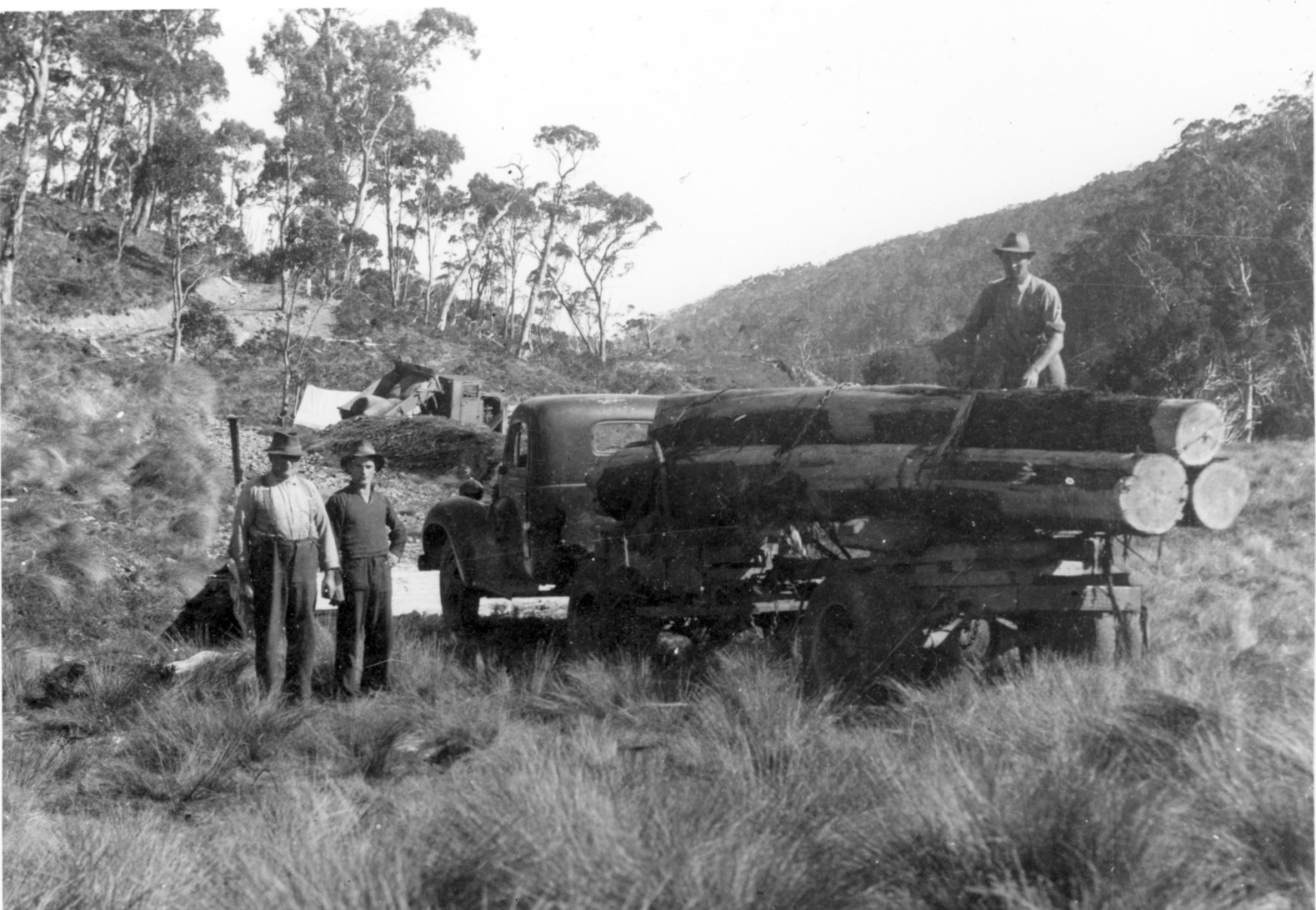
First load of logs from Mount Kate, 1943, with (left to right) George, Bernard and Leo Stubbs. Ron Smith photo, courtesy of Charles Smith.
The Mount Kate sawmill dispute and dissolution of the CMRB
The pitfalls of having vested interests on a government board again became apparent in December 1943 when Ron Smith took advantage of wartime stringency, rising timber prices and a finished access road to start harvesting King Billy pine on his property at Mount Kate. Over the next few years the definition of conflict of interest and the limits of official jurisdiction became increasingly blurred, as private land was resumed at Cradle Valley and the problematic CMRB was dissolved. Ironically, Smith and the Launceston syndicate had previously offered their land to the government but been refused. With Waldheim compulsorily acquired, Lionel Connell resigned as ranger. His sons Esrom and Wal were later reemployed in their own right as rangers at Cradle Mountain and Lake St Clair. The appointment of the Cradle Mountain National Park Board in 1947 was the first step in placing the national park—as it was now known for the first time—on a sound footing, 25 years after the scenic reserves were initially gazetted. But the battle of ecology and economy continued.
[1] Gerard Castles, ‘Handcuffed volunteers: a history of the Scenery Preservation Board in Tasmania 1915–1971’, BA (Hons) thesis, University of Tasmania, Hobart, 1986.
[2] This was the Scenery Preservation Act (1921). For an example of fears of loggers being locked out of the Cradle Mountain and Lake St Clair Scenic Reserves, see E Alexander, ‘Cradle Mountain park: claims of timber area’, Advocate, 22 August 1921, p.5.
[3] ‘Fur farming: Cradle Mountain unsuitable: area further south chosen’, Mercury, 17 August 1925, p.6.
[4] ‘Lure of the skins’, Advocate, 22 August 1925, p.12.
[6] Proclamation, Tasmanian Government Gazette, 8 March 1927, p.753.
[7] Proclamation, Tasmanian Government Gazette, 31 May 1927, pp.1412–13.
[8] Gerald Propsting to the secretary for Public Works, 4 August 1927, AA580/1/1 (TA); ‘Game Protection Act: illegal possession of skins’, Mercury, 17 August 1927, p.5.
[9] Fred Smithies, transcript of an interview by Margaret Bryant, 15 June 1977, NS573/3/3 (TA).
[11] Ron Smith to National Park Board Secretary Clive Lord, 27 August 1928, NS234/19/1/20 (TA).
[12] Paddy Hartnett to ET Emmett, 26 November 1928, PWD24/1/3; Director of Public Works to LM Shoobridge, Chairman of the National Parks Board, 13 March 1931, NS234/17/1/17 (TA).
[13] Bert Nichols to Ron Smith, 26 April 1931, NS573/1/1/4 (TA).
[14] Kevin Anderson, ‘Tasmania revisited: being the diary of Kevin Anderson, in which he related the incidents of his travelling to and through Tasmania with his companion, William Foo, from 12th April 1939 to the 26th April 1939’, unpublished manuscript (QVMAG), p.27.
[16] Bernard Stubbs interviewed by Nic Haygarth, c1993; Esrom Connell, in writing to Percy Mulligan, 20 September 1963 (NS234/19/122, TA), claimed to possess a diary in which Weindorfer recorded the failure of the motorbike to start. The present whereabouts of the diary are unknown. For the coronial inquiry into Weindorfer’s death, see AE313/1/1 (TA). The coroner determined the cause of death to be heart failure.
[17] ‘Papers relating to Coronial Enquiry into death of Gustav Weindorfer’, AE313/1/1 (TA).
[18] On 17 April 1928 Weindorfer wrote in his dairy, ‘This is very likely my last trip on the mountain’ (QVMAG). If he had a buyer for Waldheim then, the deal must have fallen through.
[19] Public Trustee to Fred Smithies, 11 November 1932, NS573/1/1/7 (TA).
[20] Minutes of the Cradle Mountain Reserve Board meeting, 26 April 1935, AF363/1/1, p.185 (TA).
[23] ‘Cradle Mountain’, Advocate, 31 July 1922, p.2.
[24] ‘Level of water raised’, Mercury, 12 October 1938, p.13.
[25] National Park Board: ‘Level of water raised’, Mercury, 12 October 1938, p.13; Davies: ‘Lake St Clair: high level “unavoidable”’, Advocate, 13 October 1938, p.6; Hurley: ‘Tasmanians asleep’, Mercury, 30 January 1939, p.8; Spurling: S Spurling, ‘Scenic vandalism’, Examiner, 5 October 1940, p.3.
[26] Ron Smith to Minister for Mines, 3 May 1938, NS234/19/1/4 (TA).
[27] For an overview of the Wolfram Mine dispute, see Gerard Castles, ‘Handcuffed volunteers: a history of the Scenery Preservation Board in Tasmania 1915–1971’, pp.51–52.
Hikers love drama. Launceston photographer Steve Spurling (Stephen Spurling III, 1876‒1962) manufactured some in 1908 when he set out on a hike with his mates Knyvet Roberts (1872‒1959) and John Burns (Jack) Scott (1873‒1915). Their journey to Lake St Clair was ‘a terror incognito!’, since they could get ‘no reliable information as to what lay before us, and were not encouraged by rumours of precipitous valleys and impassable bogs …’[1]
In other words, Spurling didn’t know who to ask for information on his proposed route. In 1908 there were no walking clubs which later acted as a repository of local hiking knowledge. Spurling had few useful maps and no access to the shepherds and hunters who had been working the lake country for decades. Had he only known, in five minutes he could have hotfooted it from his office at Spurling Studios down to the legal firm of Law & Weston & Archer, two of the principals of which had, as schoolboys, crossed the lake country to Lake St Clair 22 years earlier.[2] Or called on Delorainite Dan Griffin, the temperamental highland journalist who had scouted the Lake Ina area for a west coast stock route, finding only a thylacine in the business of taking a leg of mutton home to her family.[3] These men could have told him where to go and what to expect.
Clean-shaven and steely-eyed, Jack Scott, Knyvet Roberts and Stephen Spurling III ready themselves for their two-week hike, 1908. Stephen Spurling III photo courtesy of the late Barney Roberts.
Spurling was then at the height of his physical powers, being instructor to the Union Jack Gymnasium Club.[4] Knyvet Roberts, a fellow traveller on Spurling’s 1905 Cradle Mountain climb, and Jack Scott, with whom Spurling had sporting connections (Union Jack Gymnasium Club, lacrosse and rifle shooting), are also likely to have been in fine fettle. They sure looked that way when Spurling photographed them gazing steely-eyed across a paddock somewhere between Deloraine and Western Creek. While his mates toted simple haversacks, Spurling, in addition to his swag and photographic case, slung a bag around his neck. How did his glass plates ever survive long enough to be processed, let alone exposed? More importantly, when did the cravat cease to be a bushwalking accessory and are we the poorer for it?
‘A pine belt, Western Highlands’, 1908, Roberts and Scott approaching a pencil pine grove on a highland lake. Stephen Spurling III photo courtesy of Stephen Hiller.
‘On the Pine River Divide, Central Plateau’, 1908, Roberts and Scott take a breather on the Great Pine Tier at one of the many tarns encountered. Brooding skies are a feature of this excursion record. Stephen Spurling III photo courtesy of Stephen Hiller.
Spurling’s purpose was to supplement the landscape catalogue of Spurling Studios. The Daily Telegraph’s Deloraine correspondent must have been suffering his own ‘terror incognito’, judging by his description of the party’s plans to cross ‘via Mount Ironstone and Lake St Clair for Cradle Mountain’.[5] The trek started inauspiciously. Alighting from the Higgs Track into a Lake Balmoral blizzard, the men set the compass for Mount Olympus, about 50 kilometres away as the crow flew. Twenty-seven-kilo packs barely provisioned them for the five days of tramping ahead, with innumerable detours around tarns, battles with bauera and dense Richea scoparia (‘gas bush’), and even a near thing with quicksand. At nightfall on Day Two they camped near ‘the lakes of the Hay Moon Marshes’ (presumably Chummy Lake and Lake Denton, near Halfmoon Marsh, Pine River) on the Great Pine Tier.
‘The Courier Lake, Western Highlands’, 1908. Stephen Spurling III photo courtesy of Stephen Hiller.
Lake Spurling (now Lake Riengeena), 1908, Stephen Spurling III photo from the Tasmanian Mail, 12 September 1912, p.24.
‘Lake Laura, Western Highlands’, 1908. In 1896 Beattie had taken the Sublime approach to Mount Ida’s towering form above this lake. Spurling’s elegantly framed photo instead captured the mountain reflections, belying the difficulty of access to the site. Stephen Spurling III photo courtesy of Stephen Hiller.
From here the trio must have swung around to the west. On Day Four they approached a large, uncharted, unnamed lake ‘almost due south of Rugged Mt [a named then used to describe the group of peaks from the Walls to Mount Rogoona and those overlooking Lees Paddocks], ’ measuring about three miles long and three-quarters of a mile wide—possibly Lake Norman or Lake Payanna in the Mountains of Jupiter. This was probably the feature Spurling dubbed the Courier Lake. Was he buttering up the Weekly Courier newspaper that bought so many of his photos? Spurling’s companions also named another lake (now Lake Riengeena) after him at the time. The serrated head of the Acropolis now loomed high in the summer haze far across the Narcissus Valley. Rounding the shoulder of ‘an unnamed mountain’ (now Mount Spurling), they scrambled down the Traveller Range to camp at Lake Laura, just to the north-east of Lake St Clair.
‘From Mount Olympus, Lake St Clair’, 1908, a misty lake shot from the rock scree high on the mountain. Stephen Spurling III photo courtesy of Stephen Hiller.
‘Drifting mists, Mount Olympus’, 1908, showing the party’s campsite at Narcissus River. Stephen Spurling III photo courtesy of Libraries Tasmania.
On Day Seven Spurling’s party resettled at the mouth of the Narcissus River, a site which would find favour with future Lake St Clair campers. After a week’s exertion, the photographer was too knackered to attend the usual dawn service of his profession. He had not stirred from his bed next morning when one of his mates roused him, ‘Steve, get up, there’s a cloud over Mount Olympus!’ By the time the lens was brought to bear, the rising mist cloaked only the mountain’s lower baffles, resulting in one of Spurling’s most striking compositions.
‘The Du Cane Range [the Guardians] from Lake Marion’, 1908. Stephen Spurling III photo courtesy of Stephen Hiller.
Spurling’s ‘Mount Gould, Lake Marion’, 1908, seems rather tame compared to Beattie’s Sublime version shot twelve years earlier. Was the pandanus planted? Stephen Spurling III photo courtesy of Stephen Hiller.
‘Cuvier Valley and Mount Olympus’, 1908. The party pauses for the photographer on its half-starved rush to Cynthia Bay. Stephen Spurling III photo courtesy of the late Barney Roberts.
Food supplies were now desperately low. After conquering Mount Olympus, base camp was moved to the Byron Gap in hope of landing some game. ‘Hedgehog’ (echidna) stew had fed the party for a while, but their snares continued to draw a blank. Lake Marion, Mount Gould and the Cuvier Valley completed the sightseeing, before the visitors made a dash for the accommodation house at the southern end of the lake, hoping to beg provisions from other tourists. The place was empty—but for a small packet of flour. Spurling, Scott and Roberts quickly turned this into a barely edible rock-hard damper. Appetites whetted, they determined to partake of the superior cuisine available at the Pearce residence, 20 kilometres away. There the ‘three wild eyed haggard bearded sun-downers’ must have presented quite a sight hoeing into their ‘Lord Mayors Banquet’.
Homeward bound, they took the stock track from Bronte to Great Lake, reaching the shepherd’s hut at the Skittleball Plains near Great Lake on the twelfth night of their journey. The 4139-acre sheep run between the Ouse and Little Pine Rivers was stocked by Edmund Johnson of Lonsdale, near Kempton. The identity of his shepherd is unknown, but he kindly offered the party his floor. Revived by their hearth-side sleep, Spurling, Scott and Roberts pulled out all stops for the final dash along the lake and down Warners Track, taking their tally for the last three days of the tramp to 130 kilometres. The reason for their haste was that at the Pearce homestead arrangements had been made to have a driver await the party with a dray at Jackeys Marsh. ‘The luxury of driving was unspeakable’, Spurling wrote in an excursion diary which, like the 1840s survey maps that might have aided him, was never published.
Spurling’s photos from the trip featured in the Weekly Courier newspaper over many months.[6] They also appeared as postcards (they are collectables today) and in ‘bioscope’ lantern slide performances which Spurling conducted in Launceston, that is, as slides incorporated into a moving picture show.[7] In 1913 he would return to Lake St Clair with a movie camera, as Simon Cubit and I detailed in Historic Tasmanian mountain huts.[8]
Major Jack Scott was killed in action at Gallipoli on 8 October 1915, having joined up in Western Australia alongside his brother Joe Scott—who likewise lost his life during the Dardanelles Campaign.[9] Knyvet Roberts, after whom Knyvet Falls, Pencil Pine Creek, are named, became a Flowerdale farmer. His son, the writer Bernard (Barney) Roberts, treasured an album of 30 photos which Spurling had given his father after the 1908 Lake St Clair trip. Barney used these photos to introduce me to the photography of Steve Spurling, for which, 30 years later, I am extremely grateful.
[1] Spurling’s unpublished account of the trip, ‘Across the Plateau’, is held by the Spurling family in Devonport. It appears to be a typed version of hand-written Spurling notes and is wrongly dated February 1913, giving the impression that the author and the typist were not one and the same.
[2] For the accounts of this trip see ‘The Tramp’ (William Dubrelle Weston), ‘About Lake St Clair’, The Paidophone, (Launceston Church of England Grammar School magazine), vol.II, no.7, September 1887, pp.7‒8; and ‘Shanks’s Ponies’ (William Dubrelle Weston), ‘A trip to Lake St Clair’, Examiner, 22 December 1888, p.2 and 29 December 1888, p.13. For Weston and Law’s hiking careers, see Nic Haygarth, ‘”The summit of our ambition”: Cradle Mountain and the highland bushwalks of William Dubrelle Weston’, Papers and Proceedings of the Tasmanian Historical Research Association, vol.56, no.3, December 2009, pp.207‒24.
[3] ‘Lake Ina’, Daily Telegraph, 24 May 1907, p.4.
[4] ‘Union Jack Gymnasium Club Annual Meeting’, Daily Telegraph, 17 March 1908, p.8.
[5] ‘Deloraine’. Daily Telegraph, 18 February 1908, p.7.
[6] Photos from the 1908 trip appeared in the Weekly Courier on 16 April 1908, p.27; 23 April 1908, p.19; 30 April 1908, p.17; 7 May 1908, p.17; 14 May 1908, p.17; 21 May 1908, pp.21 and 22; 28 May 1908, p.17; 11 June 1908, p.24; 2 July 1908, p.17; 9 July 1908, pp.17 and 23; 16 July 1908, p.22; 23 July 1908, p.23; 6 August 1908, pp.20 and 24; 31 December 1908, pp.21 and 24.
[7] See, for example, ‘Bioscope entertainment’, Daily Telegraph, 29 September 1908, p.3.
[8] ‘Hartnett’s huts’, in Simon Cubit and Nic Haygarth, Historic Tasmanian mountain huts: through the photographer’s lens, Forty South Publishing, Hobart, 2014, pp.76‒83.
[9] ‘Major JB Scott killed: brothers make the supreme sacrifice’, Examiner, 16 October 1915, p.6.
William Dubrelle Weston, aka ‘Peregrinator’. Photo from the Launceston Family Album, courtesy of the Friends of the Launceston LINC.
Ernest Milton Law, Weston’s hiking and legal partner. Photo from the Launceston Family Album, courtesy of the Friends of the Launceston LINC.
In March 1886 the pastoralist Alfred Archer of Palmerston, south of Cressy, guided two Launceston schoolboys across the Central Plateau through poorly charted country to Lake St Clair.[1] This was the first in a series of extraordinary highland excursions for sixteen-year-old William Dubrelle Weston (1869–1948) and fifteen-year-old Ernest Milton Law (1870–1909). Later adventures would include probably the first bushwalk to the Walls of Jerusalem, visits to Great Lake and Mount Barrow, and the first two tourist trips to Cradle Mountain—‘the summit of our ambition’.[2]
On most of these expeditions they would be joined by two chums they knew from the Launceston Grammar School, the brothers Richard Ernest Smith (1864–1942), known as Ernest or ‘Old Crate’, and Alfred Valentine ‘Moody’ Smith (1869–1950). Weston’s letters from the period show the friends’ high-spirited camaraderie, and how hiking relieved the stresses of study, career, faith, self-discipline and social life during the transition from adolescence to manhood. Bushwalking was already popular in Tasmania, with accounts of highland excursions appearing regularly in newspapers.
Cradle Mountain and Dove Lake, as Peregrinator’s party would have seen them, without tourist infrastructure. HJ King photo courtesy of Maggie Humphrey.
Why did they choose Cradle Mountain in 1888? The peak received few visitors. No ascents are recorded between James Sprent’s trigonometrical survey in about 1854 and that by Dan Griffin and John McKenna in March 1882.[3] The discovery of gold on the Five Mile Rise on the western side of the Forth River gorge had increased traffic towards Cradle on the old Van Diemen’s Land Company Track, but the peak itself remained more remote from Launceston than even Lake St Clair was.
However, the Launceston Grammar old boys were now confident, independent bushwalkers. The Smith brothers were in charge of the commissariat. Alf was the hunter of the party, armed with a rifle. Currawongs and green parrots were landed on the way to Cradle Mountain, although a snake despatched by two weapons was left off the menu. Porridge, bread and butter, johnny cakes and beef fed the party at other times. Water proved so scarce that on the Five Mile Rise (near today’s Mail Tree or Post Office Tree on the Cradle Mountain Road) it was squeezed out of moss, a decoction that not even the addition of the emergency brandy and whisky could make palatable.
The party attempted to reach Cradle not by today’s tourist route across the Middlesex Plains, then south to Pencil Pine Creek, but by the direct route which took them into the deep, scrubby Dove River and Campbell River gorges. This was the hunters’ route to Cradle, but Weston’s party soon lost their way. With supplies dwindling on their fifth day out, there was nothing for it but to turn for home. Weston, who had taken to writing under the pseudonym of ‘Peregrinator’ or ‘Mr Peregrinator’, had been tantalised by Cradle’s ethereal heights:
‘Before us rose the imposing mass of the mountain; to our right was another stupendous gorge; and high above it and us a splendid eagle sailed in clam serenity, above all the ups and downs of terrestrial life and toil.’[4]
Ernest Smith wrote of the same vista months late: ‘I have that scene as vividly before me now while I am writing as if I were there, and I shall have until I die’.[5] There was no question but that they would return.
Two summers passed before ‘the old Company’ could reassemble, and they did it without ‘Moody’ Smith. ‘At last Mr Peregrinator and two friends got loose from their respective occupations’, Weston opened his second Cradle Mountain narrative. Infrastructure had improved in the three years since their last Cradle adventure. The Mole Creek branch railway, a new Mersey River bridge and the Forth River cage (flying fox) expedited travel. For a second time Fields’ Gads Hill stockman Harry Stanley doubled as their official weighbridge. That this time their packs averaged about 49 lbs (22 kg) each, compared to 43.5 lbs (20 kg) on the previous trip, suggests heavier provisioning in an effort to secure their goal. Extra cocoa, ship’s biscuit, porridge, rice and tea probably came in handy—as did bushranger Martin Cash’s autobiography—when time lost to rain extended the trip to thirteen days.
The four chose the easier route via Middlesex Station, which proved a useful staging-post, and provided a stockman to guide them onwards. Like other early Cradle climbers, Peregrinator’s party mistook the more obvious north-eastern end of the mountain for the summit. They then had to dodge the series of intervening spires to reach the true summit at the south-western end, where they found the timber remains of James Sprent’s trigonometrical station.[6] Standing on Cradle’s pinnacle—the ‘summit of our ambitions’—in perfect stillness, with the island spread out below him, Weston struck a melancholic note:
‘We had been seeking grandeur of nature and now we beheld its plaintive softness … Sound, there was none. Yonder stood the frowning buttresses of the mountain … many a glistening silver line revealed a stream plunging in headlong fury down the distant slopes, and there asleep in the very arms of nature herself lay a tiny lakelet [probably Lake Wilks], whose breast was sacred e’en to the evening zephyr. How comes it that so much of this world’s intensest scenes of beauty are set in a minor key?’
Sadly, Weston recognised that the party’s hiking career ended then and there on the summit. Now aged from 20 to 26 years, the men would soon sacrifice their youth and their physical prime to adult responsibilities. Yet Weston’s usual picaresque banter, historical footnotes and topical commentary enlivened their extraordinary ‘final push’ home—about 45 km from Middlesex Station to Sheffield by foot in a day. Peregrinator’s romantic description of the jewels of the night guiding his descent from the Mount Claude saddle must have raised eyebrows among those who knew the place only for labour with pack-horse and bullock team on their way to the gold mines on the upper Forth River. After alighting from the train in Launceston, the trio made straight for the photographer’s studio and there immortalised ‘the old Co’s’ swansong. ‘The closing scene was enacted some days later when we called for our proofs’, Peregrinator concluded.
‘On our appearance we were some time making our photographer perceive that we were the same individuals, who had called in with the black billies and aspiring beared a few days before. And now the Cradle trip like many like it remains a please reminiscence of the past and a joy for the future.’[7]
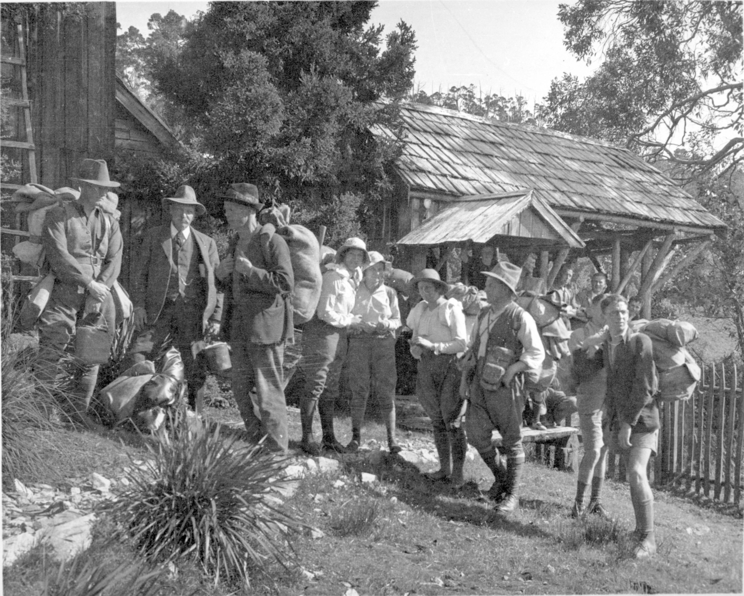
William Dubrelle Weston (2nd from left) with guide Bert Nichols (3rd from left) before setting out from Waldheim to climb Cradle Mountain in 1933. Fred Smithies photo courtesy of Margaret Carrington.
It is unlikely that Alf ‘Moody’ Smith, who became a Church of England minister in New South Wales, ever stood on the summit of Cradle Mountain. Ernest Law never repeated the adventure, dying, tragically, of typhoid in 1909, aged only 38. Neither Ernest Smith nor Weston renounced hiking altogether, with the former leading boys on mountain treks in his career as a school-teacher. But only Weston returned to the top. In 1933, 45 years after he first tackled Cradle Mountain and now 64 years old, he noted in the Waldheim Chalet visitors’ book at Cradle Valley:
‘With thankfulness to God’s goodness it is recorded that WD Weston who led the first Launceston party (late Ernest M Law and Mr Richard Ernest Smith) in December 1890–January 1891 (ascent Jan 2nd 1891) reascended to the trig on the Cradle 28th December 1933’.[8]
Ironically, the urban conqueror of Lake St Clair, the Walls of Jerusalem and Cradle Mountain more than four decades earlier, was now led to the summit by Overland Track guide Bert Nichols, a bushman fifteen years his junior. It is fitting that such an early spruiker of highland tourism should return to walk part of the ‘new’ track that popularised the region.
[1] ‘The Tramp’ (WD Weston), ‘About Lake St Clair’, The Paidophone, vol.II, no.7, September 1987, pp.7–8; ‘Shanks’ Ponies’ (WD Weston), ‘A trip to Lake St Clair’, Launceston Examiner, 22 December 1888, p.2.
[2] See Nic Haygarth, “’The summit of our ambition”: Cradle Mountain and the highland bushwalks of William Dubrelle Weston’, Papers and Proceedings of the Tasmanian Historical Research Association, vol.56, no.3, December 2009, pp.207–24.
[3] ‘The Tramp’ (Dan Griffin), ‘In the Cradle country’, Tasmanian Mail, 8 February 1897, p.4.
[4] ‘Peregrinator’ (WD Weston), ‘Notes of a trip in the vicinity of the Cradle Mountain’, Colonist, 17 March 1888, p.4.
[5] RE Smith to WD Weston, date illegible, CHS47, 2/55 (Queen Victoria Museum and Art Gallery [henceforth QVMAG]).
[6] ‘Peregrinator’ (WD Weston), ‘Up the Cradle Mountain: no.3’, Launceston Examiner, 4 March 1891, supplement, p.2.
[7] ‘Peregrinator’ (WD Weston), ‘Up the Cradle Mountain: no.5’, Launceston Examiner, 11 March 1891, supplement, p.1.