Posted on

‘This mountain may run your motor car’: the early struggles of the Cradle Mountain–Lake St Clair National Park

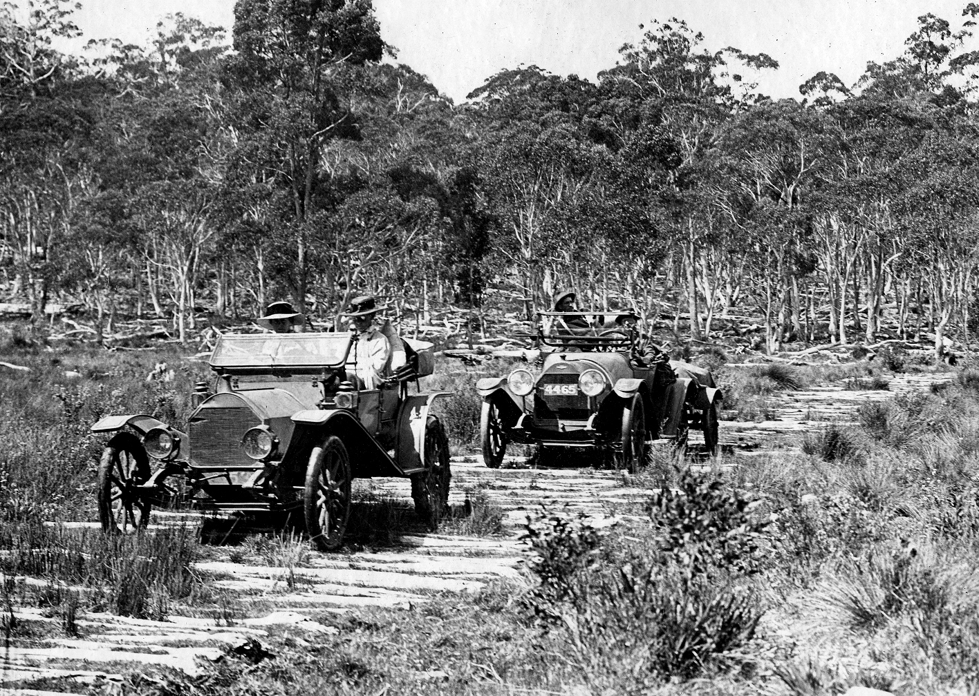
Mining in a scenic reserve? A fur farm as well? How about damming a protected lake to generate power? Bring it all on. During its first 25 years the Cradle Mountain–Lake St Clair National Park was a free-for all.

The national park might have been sparked by a sermon on Cradle Mount but its implementation was more like a meditation on patience. In the 1920s economy reigned over ecology in Tasmania. With the state considered an economic basket case, government had little appetite for funding national parks or for standing in the way of resource exploitation. The Scenery Preservation Board which nominally managed the park had only advisory powers and was, as Gerard Castles suggested, ‘handcuffed’ to this development ethos.[1] Voluntary park administrators attacked their task with a passion. However, their efforts were clouded by conflicts of ideology and pecuniary interest. The first two decades of park management were beset with challenges from the mining, fur and timber industries and the government mantra of hydro-industrialisation. Even the local experts employed to build, maintain and oversee park infrastructure and guide tourists were ‘exploiters’—fur hunters and mineral prospectors. The idea of a road from Cradle Mountain to Lake St Clair was entertained on the ‘bigger, better and more accessible’ social justice principle that has been used time and time again in Tasmania to justify development of natural assets. What a mess!

Waldheim in the Weindorfer era. Fred Smithies photo, courtesy of Margaret Carrington.


Getting to Cradle Mountain in 1924, the Citroen-Kegresse prototype, which Weindorfer called the ‘platypus motor’. Stephen Spurling III photo.

Origins of the park

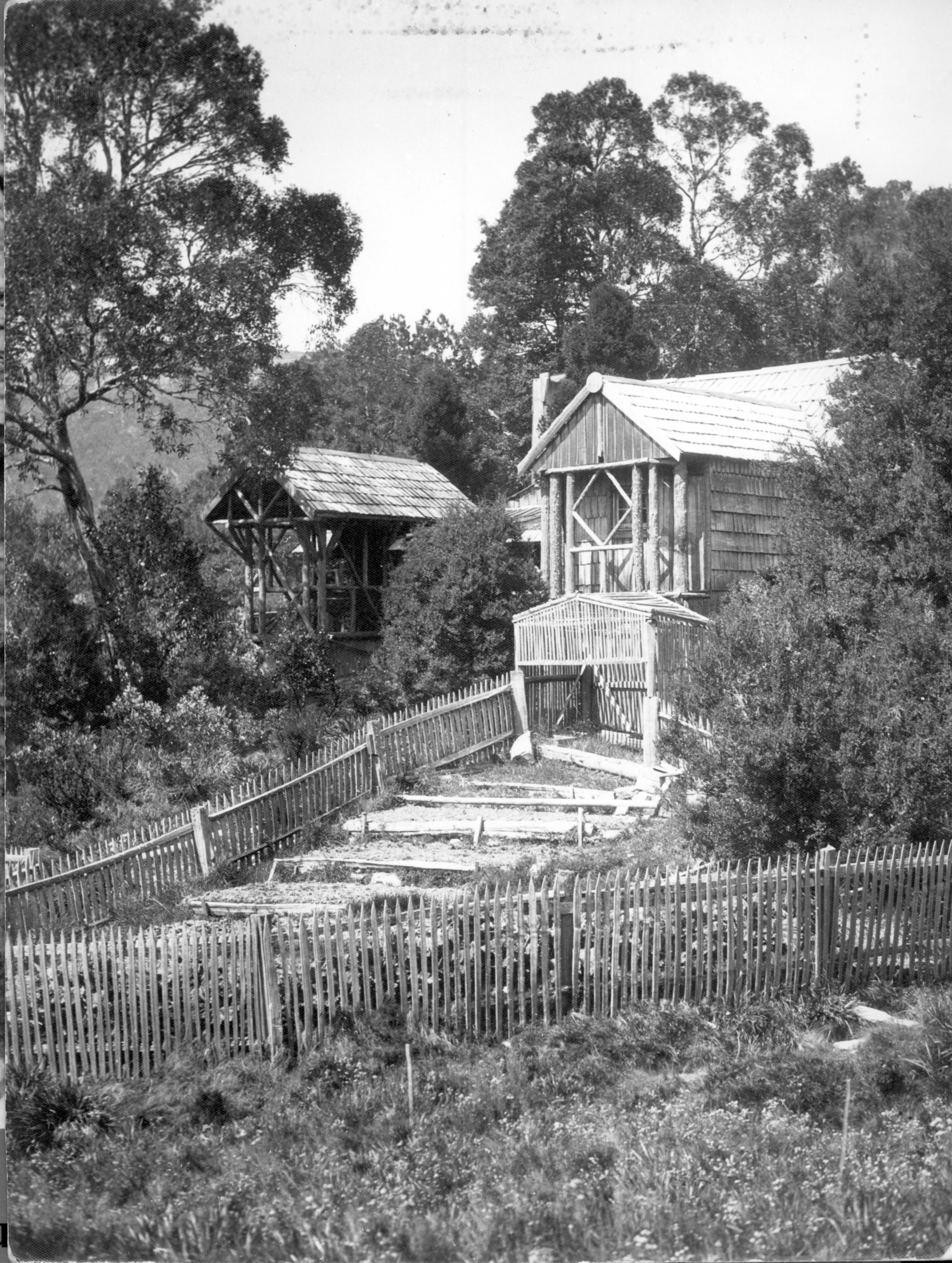
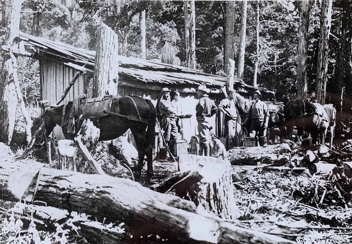
The Cradle Mountain–Lake St Clair National Park had three starting points: Cradle Mountain, the Pelion/Du Cane region, and Lake St Clair. At Cradle Valley Gustav and Kate Weindorfer established a tourist resort called Waldhiem in 1912. The story of how they built it and almost no-one came has been told a thousand times. In the Pelion/Du Cane region hunter/prospector Paddy Hartnett had a network of huts, some of which doubled as staging posts for his guided tours as far south as Lake St Clair. Three industrial-size skin drying sheds which stood near Pelion Gap, at Kia Ora Creek and in the Du Cane Gap give some idea of the scale of hunting operations before and after World War One (1914–18). Hartnett’s Du Cane Hut remains today. Lake St Clair had been visited fairly regularly by Europeans for almost a century. It was effectively reserved in 1885 when a half-mile-wide zone around its shores was withdrawn from selection. The Pearce brothers built a government accommodation house, boat house and horse paddock at Cynthia Bay 1894–95 but the buildings were destroyed by fire in 1916.

Paddy Hartnett’s massive skin shed near Kia Ora Creek, 1913. Stephen Spurling III photo courtesy of Stephen Hiller.

When Gustav Weindorfer declared famously that ‘this should be a park for the people for all time’, he meant only the Cradle Mountain–Barn Bluff area in which he later operated. Other park proponents, including Director of the Tasmanian Government Tourist and Information Bureau ET Emmett, and bushwalker photographers Fred Smithies, Ray McClinton and HJ King, were familiar with a much greater area. They wanted to include the swathe of land from Dove Lake to Lake St Clair, making an area about six times the size of the Mount Field National Park.

The Scenery Preservation Act (1915), under which the Freycinet Scenic Reserve and National Park (Mount Field National Park) were gazetted in 1916, forbade the lighting of fires, cutting of timber, shooting of guns, removal or killing of birds and native or imported game and damage to scenic or historic features on reserved land. The Act therefore effectively forbade hunting but it did not expressly forbid mining, even though mining always included the lighting of fires and cutting of timber. Parts of the proposed national park area were already logged, grazed, hunted and mined, and to allay fears of these primary industries being locked out of a proclaimed reserve, in 1921 the Act was amended to allow exemptions from the provisions of the original Act.[2]

Stephen Spurling III photo, from file AB948/1/225, Tasmanian Archives.


The Pelion oil field

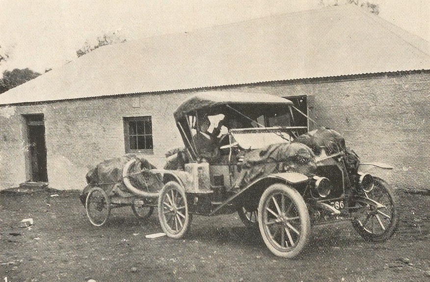
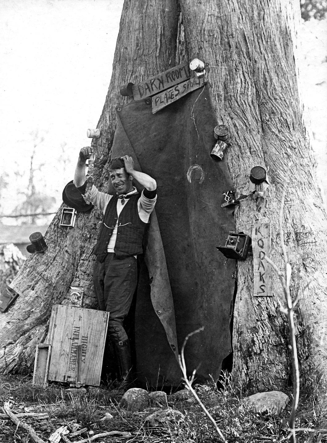
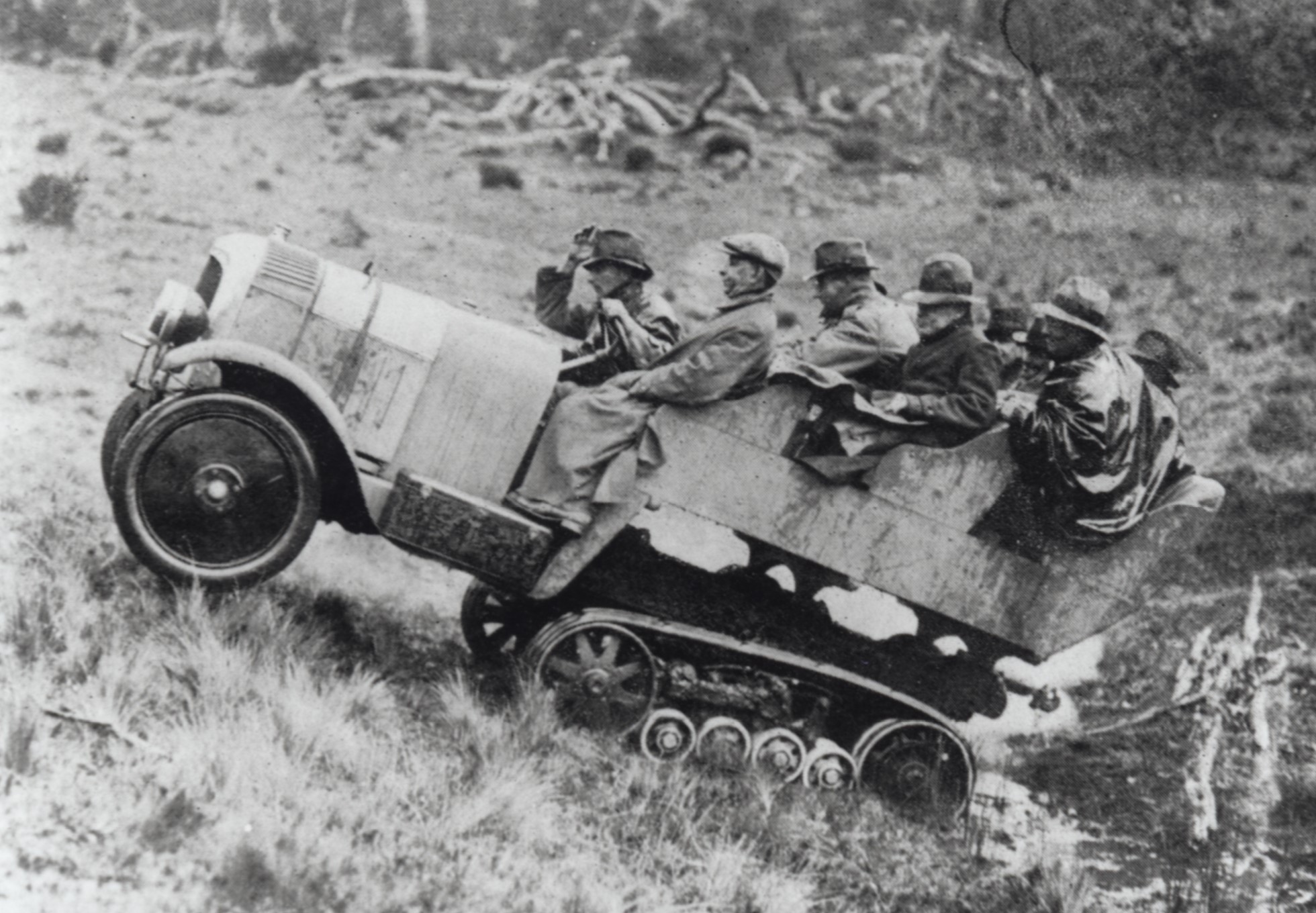
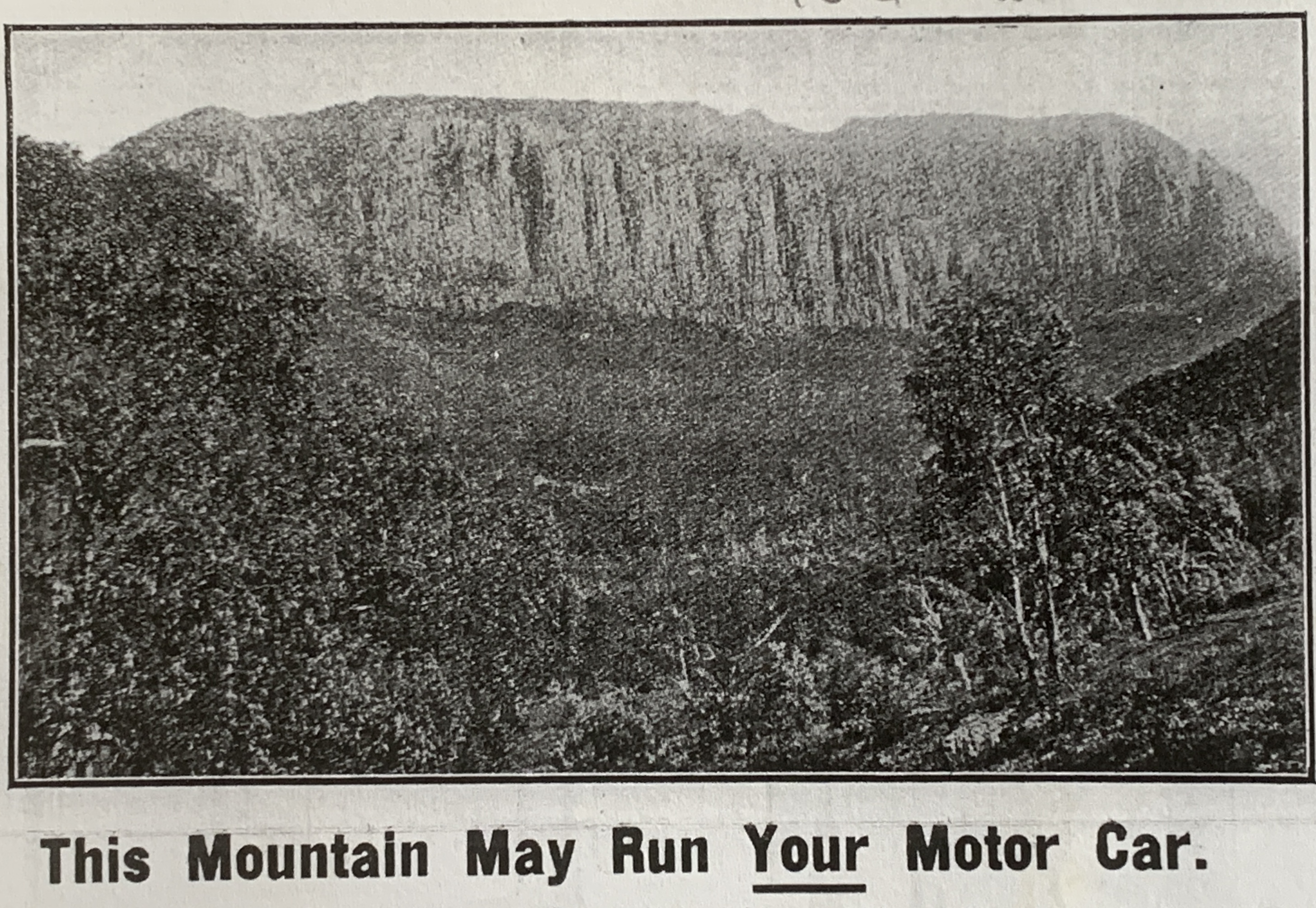
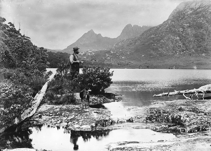
World War One (1914–18) had created anxiety about resource security in Australia and precipitated revolution and civil war in Russia. Outcomes for Tasmania included the search for shale oil reserves and a boom in the Tasmanian fur industry, with brush possum skins helping to make up for the loss of Russian fur reserves. While a lantern lecture campaign promoted the idea of a Cradle Mountain national park in 1921, about 80,000 acres of the land in question was under exploration lease in the search for shale oil (‘inspissated asphalite’). The Adelaide Oil Exploration Company used a Spurling photo to push the idea that Mount Pelion West was a motor oil bonanza. Its proponents assured would-be investors that its lease contained ‘the greatest potential amount of wealth hitherto controlled by any one concern in the British Empire, and, probably, in the whole world, outside the United States of America’. Faith might be able to move mountains, but the government geologist assured them it couldn’t put oil in these mountains. The only lasting impact of oil exploration was the Horse Track south from Waldheim, which was marked to enable pack horses to supply coal/oil operations at Lake Will.

Gustav Weindorfer hunting at Lake Lilla with his dog Flock, 1922.
Stephen Spurling III photo courtesy of Stephen Hiller.


The Cradle Mountain fur farm

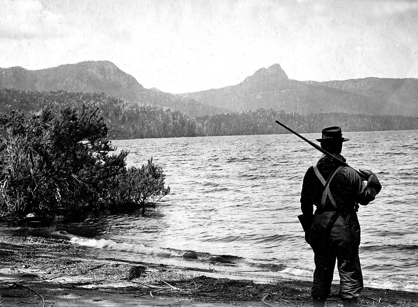
The Cradle Mountain and Lake St Clair Scenic Reserves were gazetted under the amended Act in 1922 but at first neither was a fauna sanctuary under the Animals and Birds Protection Act (1919). With the surge in hunting it was inevitable that fur farming on the Canadian model was proposed for Tasmania. The Fur Farming Encouragement Act (1924) reserved 30,000 acres at Cradle Mountain for a fur farm, but before local hunters could protest, in 1925 this area was dismissed as unsuitable by two of the scheme’s proponents, Melbourne skin buyers who, extraordinarily, believed that ‘furs grown at a high altitude have not the good texture of those grown on the low lying country’.[3] Nobody seems to have counselled Tasmanian hunters that high country furs were inferior. Working at Lake St Clair in the winter season of 1925, Bert Nichols reportedly made the small fortune of £500, his possum skins fetching 17 shillings 11 pence and his wallaby skins more than 12 shillings each at the Sheffield Skin Sale.[4] This was at a time when the average annual wage for a farm worker was about £110 to £125.[5]

Two subsidiary management boards

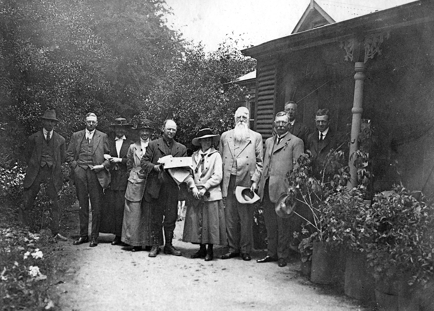
Two subsidiary bodies were appointed to advise the Scenery Preservation Board on matters relating to the two adjoining scenic reserves. One, the National Park Board, already helped manage the Mount Field National Park. Chaired by botanist Leonard Rodway, with Tasmanian Museum director Clive Lord as its secretary, it now added the Lake St Clair Scenic Reserve to its purview. The other body, which administered the Cradle Mountain Scenic Reserve, was created from nominated representatives of interested organisations and municipal councils plus several people who had campaigned for the reserve’s creation.[6] Ron Smith (Cradle Mountain Reserve Board secretary from 1930) and Fred Smithies became standard bearers for the 68,000-acre Cradle Mountain Reserve, but their simultaneous ownership of land at Cradle Valley inevitably led to a conflict-of-interest situation.

Fred Smithies’ photo of ‘a trapper’s hut near Lake St Clair’,
Weekly Courier, 8 August 1928. Courtesy of Libraries Tasmania.


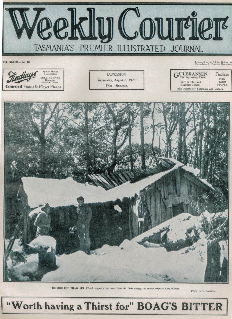
During 1927 the Cradle Mountain and Lake St Clair Scenic Reserves were gazetted as fauna sanctuaries.[7] Two months later the hunter/prospector Dick Nichols was nabbed for poaching at a hunting hut in the Cuvier Valley. His brother Bert was probably around somewhere too but escaped detection, and it became clear that they had a network of hunting huts around Lake St Clair and in the Cuvier Valley.[8] Fred Smithies, a member of the CMRB, was used to sleeping among the drying pelts in Bert Nichols’ Marion Creek Hut.[9] In the winter of 1928 he took a lovely photo of it under snow and this poacher’s hut in a fauna sanctuary made the front cover of the Weekly Courier newspaper![10] Nichols later duplicated the hut for the use of Overland Track walkers.

The Overland Track

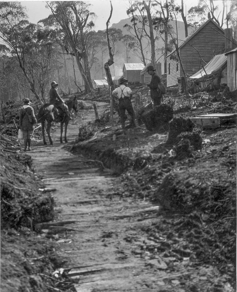
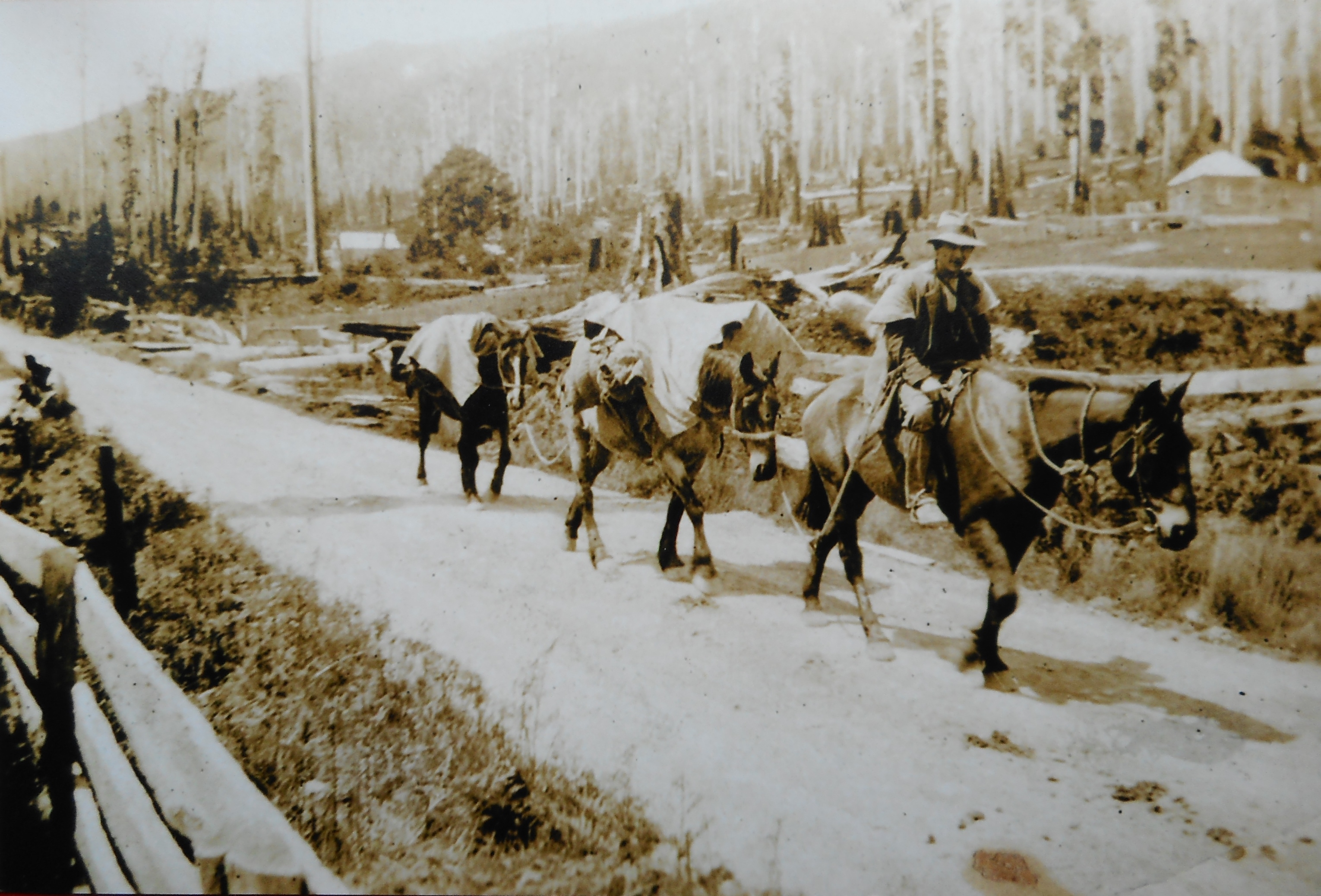
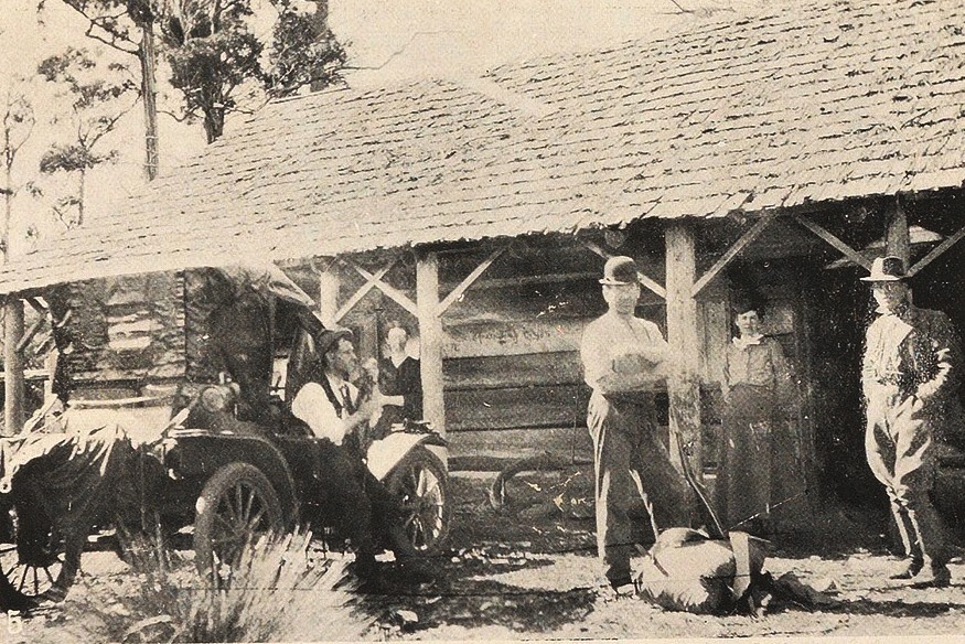
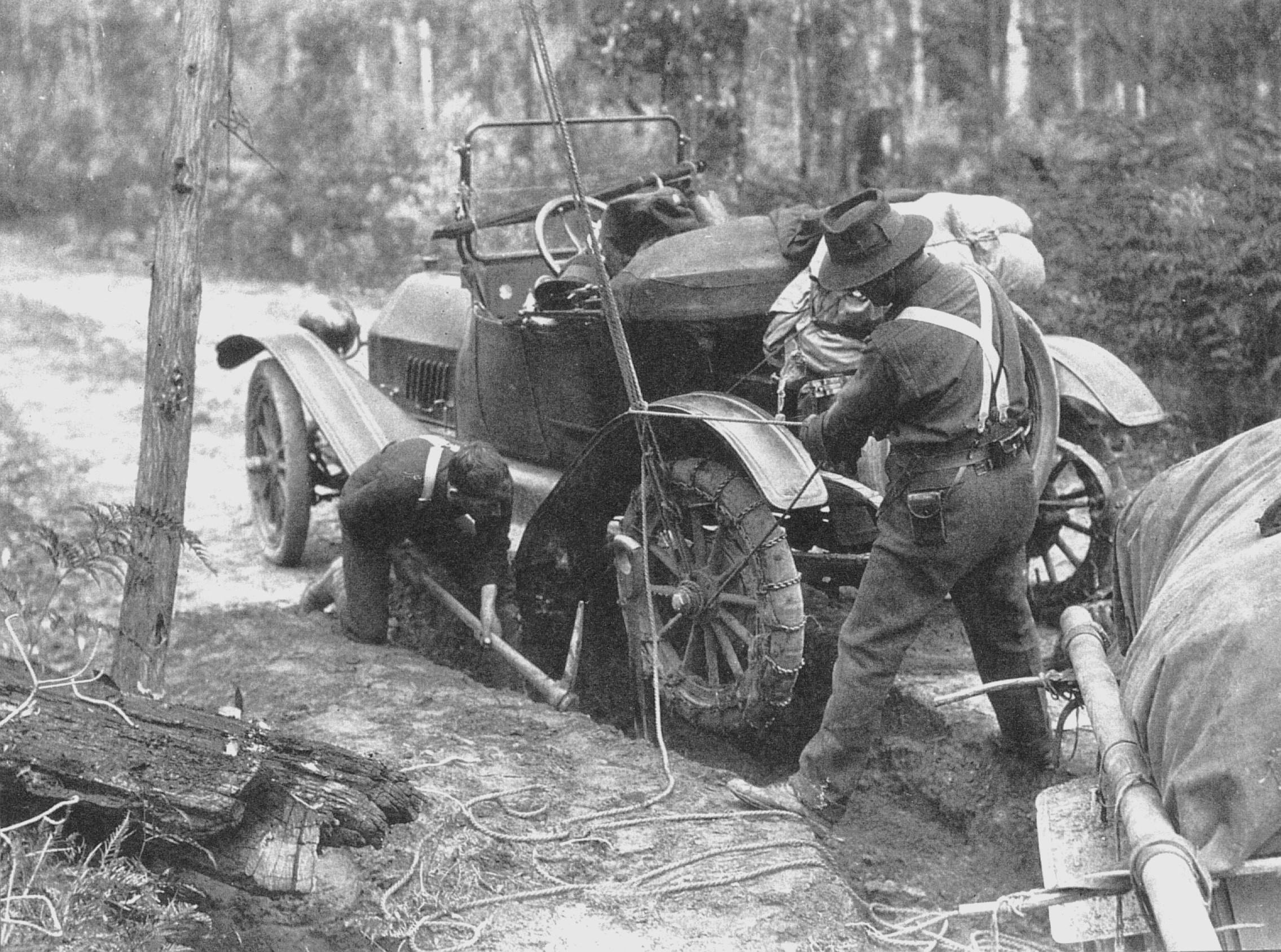
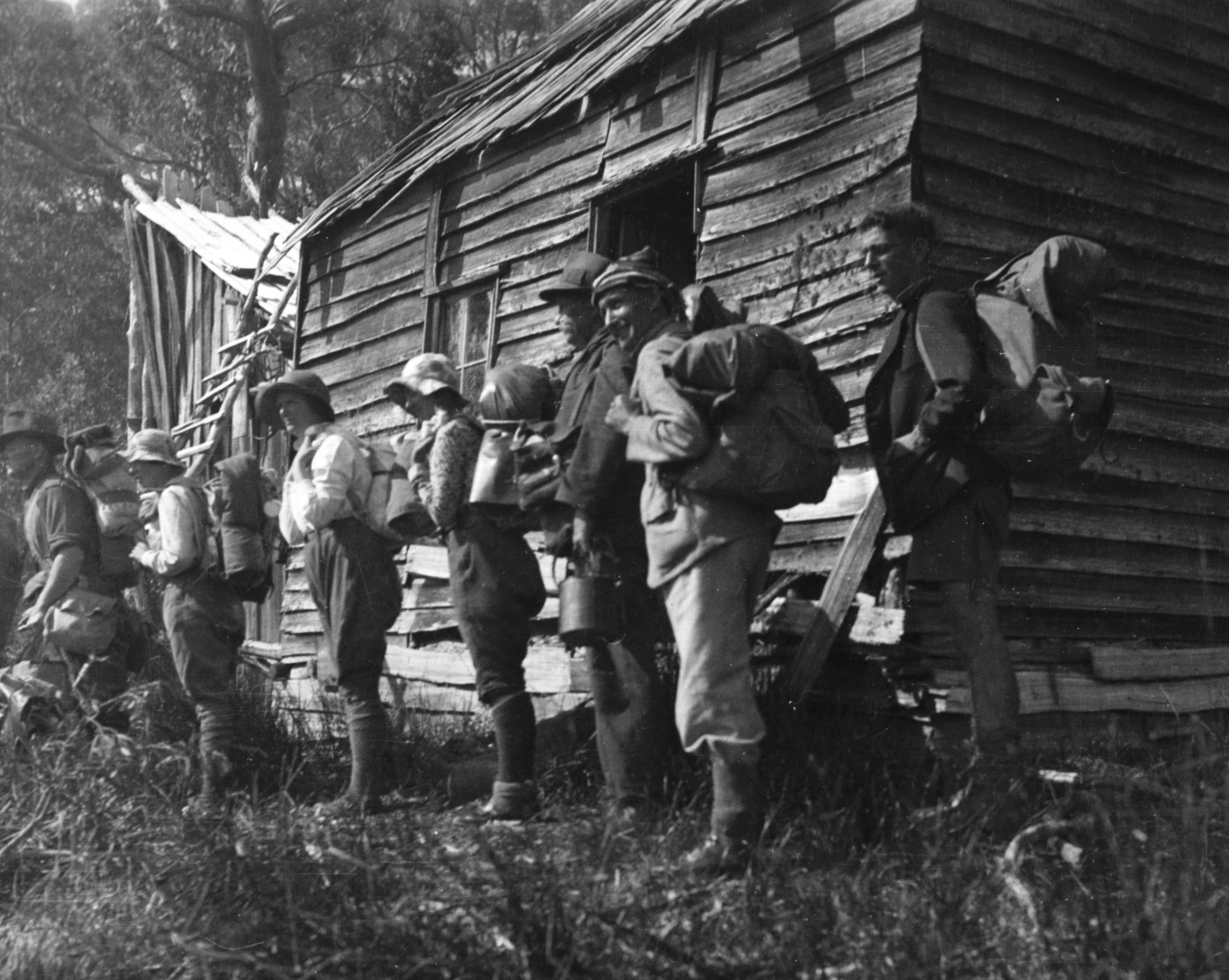
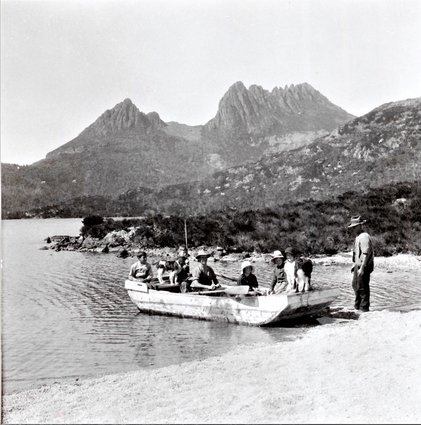
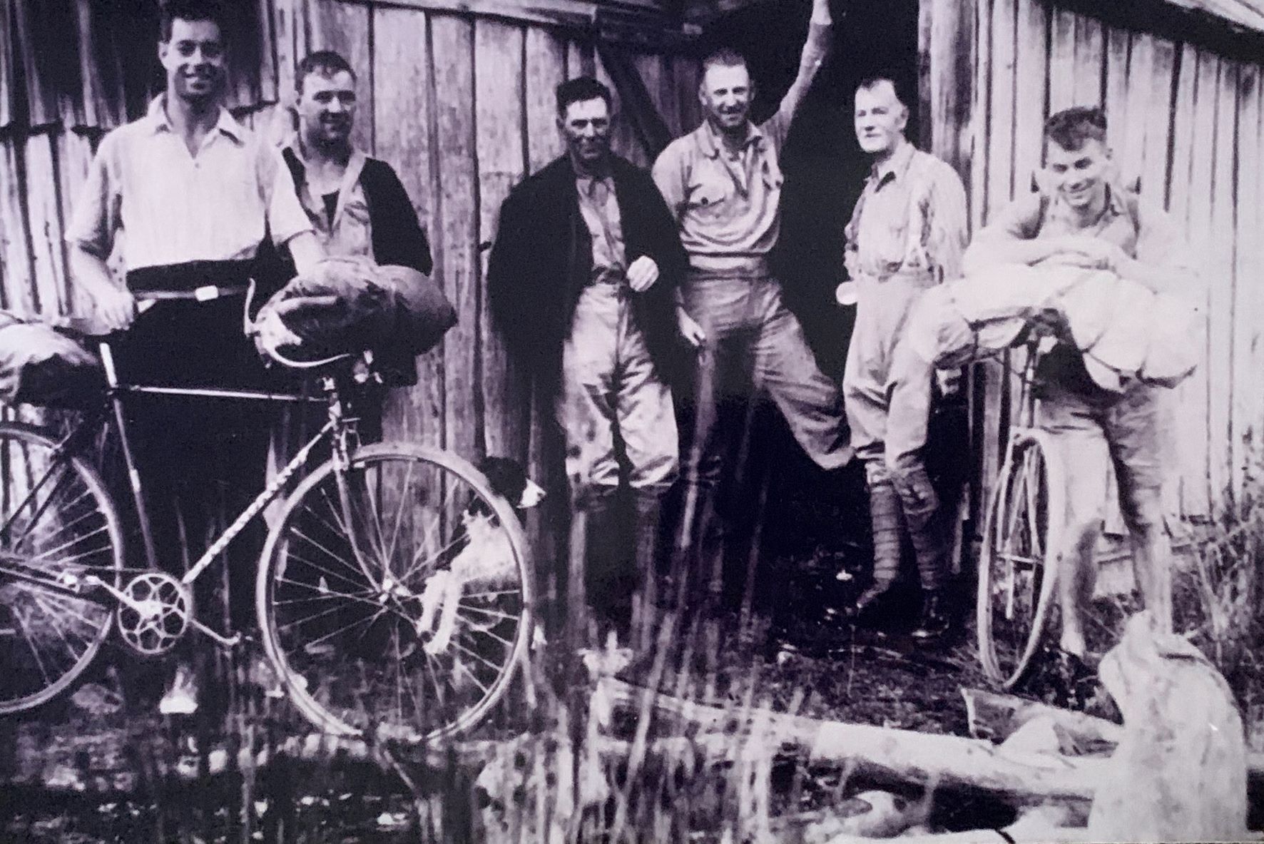
The idea of threading a track through the two reserves to unite them seems to have started with Ron Smith, who in 1928 envisaged an ‘overland track’ connecting Cradle Mountain and Lake St Clair, including a motor boat service on the lake.[11] Sections of track that could be linked already existed, including that marked by Weindorfer from Waldheim to Lake Will (the basis of the Horse Track), the Mole Creek Track between Pelion Plain and Pine Forest Moor, and hunters’ tracks from Pelion Plain through to Lake St Clair and the Cuvier Valley. Paddy Hartnett offered to cut the Overland Track for £440, but Bert Nichols did it for only £15.[12] He connected up sections of track and cleared others south of Pelion Plain to form the Overland Track in 1931.[13] Mining, hunting and tourism huts like Old Pelion, Lake Windermere and DuCane were adopted as staging posts along the track.

In 1934 Fergy established this dining room and associated huts at Cynthia Bay, Lake St Clair. Norton Harvey photo.


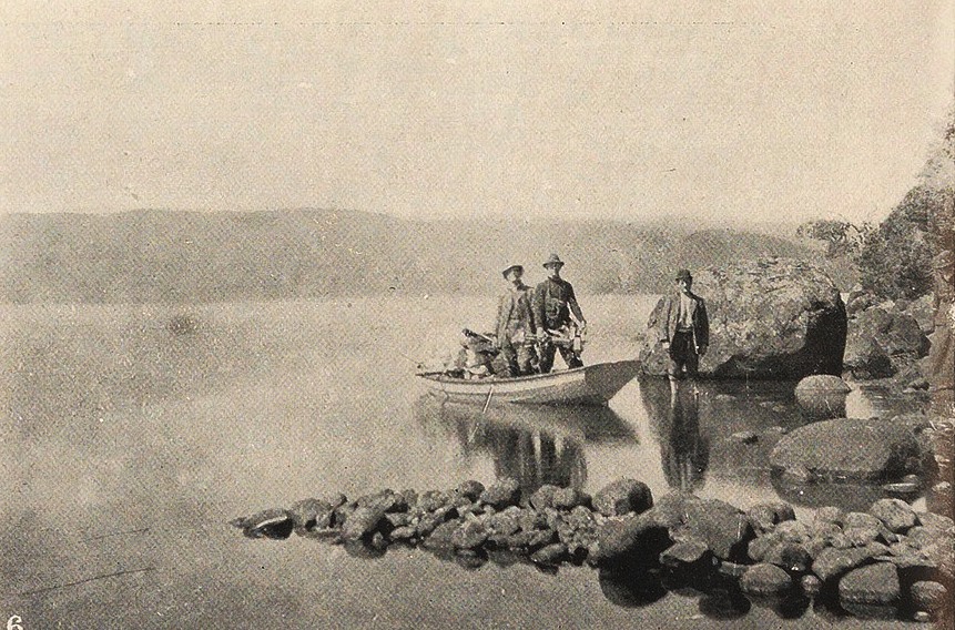
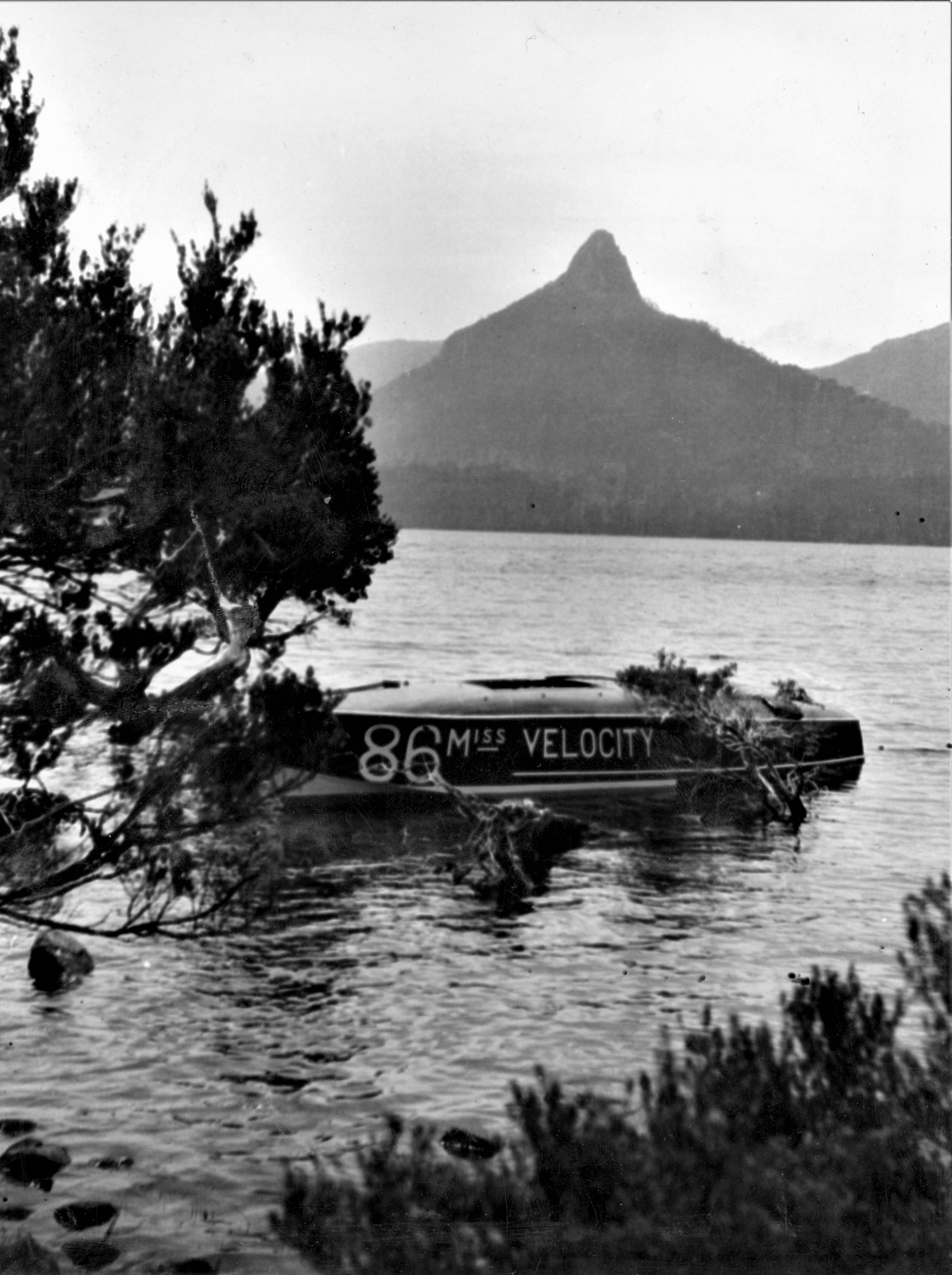
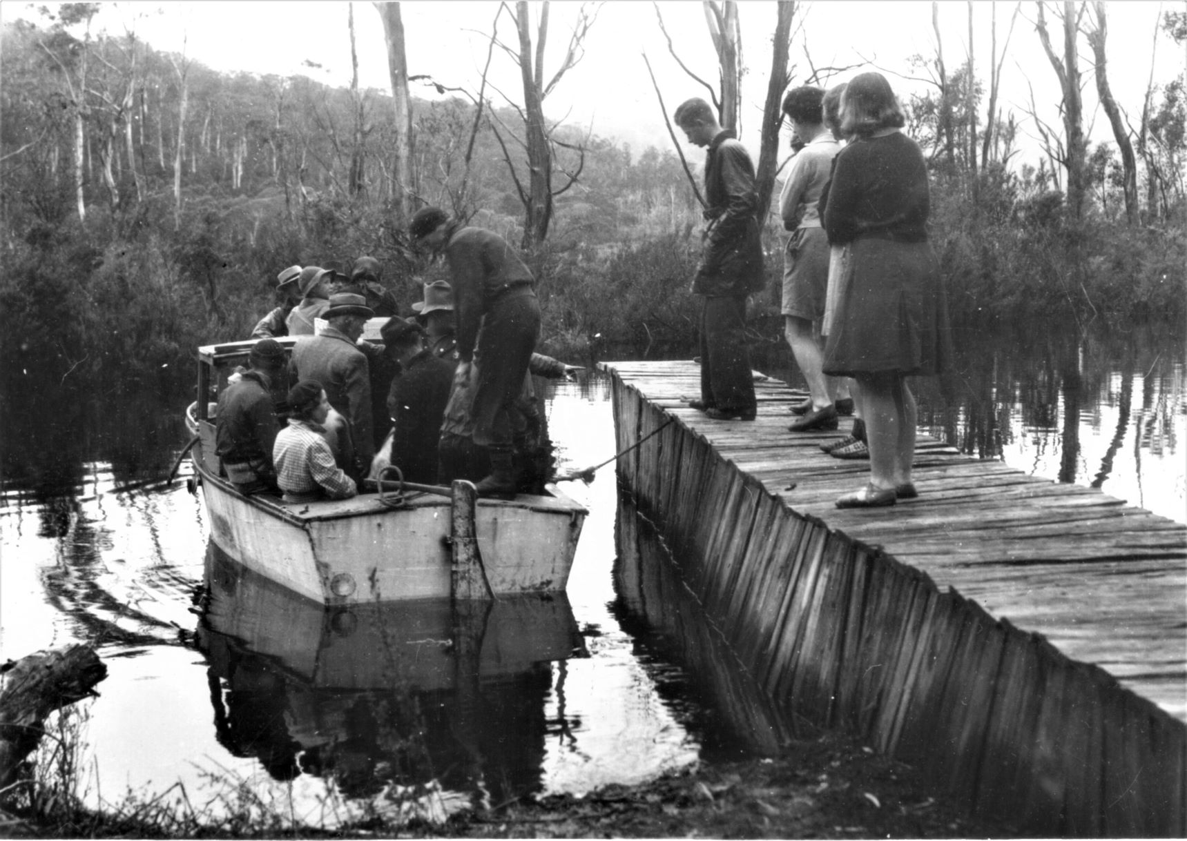
Although the official Overland Track went through the Cuvier Valley, it soon became standard procedure to cross Lake St Clair instead on tourist operator Albert ‘Fergy’ Fergusson’s motorboat. During the Great Depression Miss Velocity was an integral part of Bert Nichols’ guided tours on the Overland Track. Fergy’s tourist camp of sixteen tent-huts with earthen floors and a communal rustic dining room rivalled Weindorfer’s set-up at Cradle Valley.[14] He employed a housekeeper and owned a ‘frightful old bus’ with sawn-off cane kitchen chairs for seats, with which he drove walkers out to the Lyell Highway at Derwent Bridge.[15]

A 1929 Bert Nichols party at Windermere Hut. Marjorie Smith photo courtesy of the late Ian Smith.


Fergy’s racing boat Miss Velocity at rest in front of Mount Ida, Lake St Clair, 1929. Marjorie Smith photo courtesy of Ian Smith.


The death and wake of Gustav Weindorfer

Gustav Weindorfer died of cardiac arrest in Cradle Valley in May 1932, apparently in the act of trying to start his Indian motorcycle.[16] His name was already inscribed on his wife Kate’s headstone at Don in anticipation of him joining her there but a group of his friends arranged his interment in front of Waldheim.[17] Ironically, despite his love of the place, for years Weindorfer had been trying to sell and leave Waldheim.[18] Now he was stuck there!

The ceremony to unveil the memorial to Gustav Weindorfer at Waldheim, 1938, with Ron Smith in the foreground at right. Fred Smithies photo courtesy of Margaret Carrington.

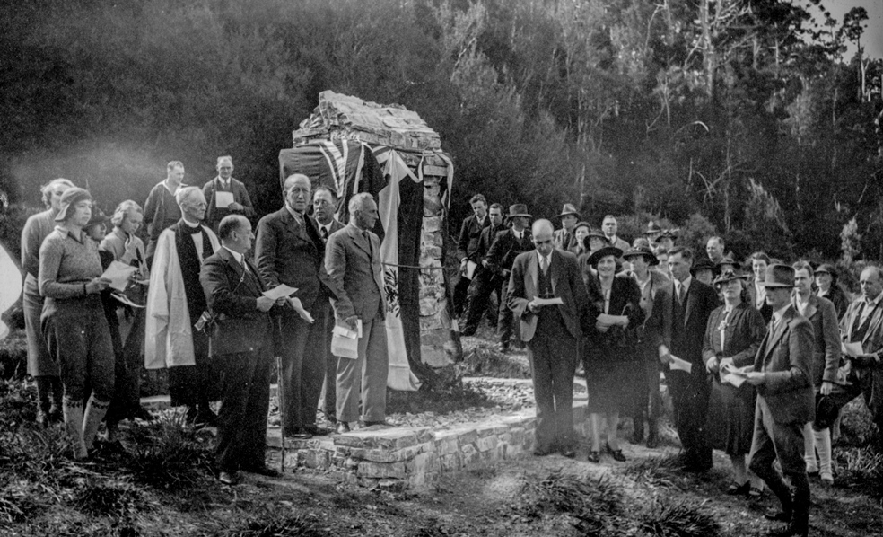
The Austrian secular tradition of remembering departed loved ones was adopted at Weindorfer’s grave after his sister Rosa Moritsch sent a bunch of flowers and four small candles from his native land. These were placed on his grave on New Year’s Day 1933. For several decades Weindorfer’s good friend Ron Smith organised the annual New Year’s Day ceremony. The annual commemoration of Weindorfer’s life has assumed possibly unparalleled longevity among Australian public figures.

The work of the Connells

First Bert Nichols and then Barrington farmers Lionel and Maggie Connell looked after Waldheim before a syndicate of Weindorfer’s Launceston friends (George Perrin, Charlie Monds, Karl Stackhouse and Fred Smithies) bought the chalet from his estate.[19] They asked the Connells to stay on as managers. Lionel Connell had been snaring around Cradle Mountain for two decades and knew the country well. The Connells, with six sons and daughters to help them, set about making Waldheim financially viable by extending the building and improving access to it.

Lionel Connell loading up Weindorfer’s punt on Dove Lake, 1936. Ron Smith photo courtesy of Charles Smith.


Os Connell digging out his family’s Sheffield–Cradle Mountain Passenger Service, 1943. Photo courtesy of Es Connell.


In the late 1930s the Connells had a tourism package for the Northern Reserve that far exceeded that of Gustav Weindorfer, ferrying visitors to and from Waldheim in their car, accommodating visitors, feeding them with produce from the farm at Barrington, guiding them around Cradle Mountain and even guiding them on pack-horse tours on the Overland Track.

Fergy’s other tub: early rangers

Ex-hunter and Overland Track guide Bert Nichols is said to have removed Overland Track markers when they were not needed in order to snare undetected in the fauna sanctuary. Nichols did other infrastructure work and was appointed ranger for two months in 1935. However, when the time came to appoint a permanent ranger the known poacher was not considered for the job.

A Lionel Connell hunting hut built with Dick Nichols still stood south of Lake Rodway as a reminder of the former’s past. Yet Connell was considered fit for a permanent posting as ranger.[20] The Connell family demonstrated great enterprise in their work at Cradle but conflict between Lionel’s roles of privately-employed tourism operator and government-employed ranger at the same location were soon obvious. To compound the issue, Connell managed Waldheim for Smithies and Karl Stackhouse. These men, as members of the CMRB, also effectively employed him as a ranger. CMRB Secretary Smith also had a family tie with the Connells.

Cyclists arriving at Old Pelion Hut, 1936. With them (left to right) are (possibly) Os Connell, Lionel Connell, Mount Field ranger HE Belcher and Director of the Government Tourist Bureau, ET Emmett. Photo courtesy of Es Connell.


Fergy overloading Miss Velocity’s more mundane replacement at Narcissus Landing, 1940. Ron Smith photo courtesy of Charles Smith.


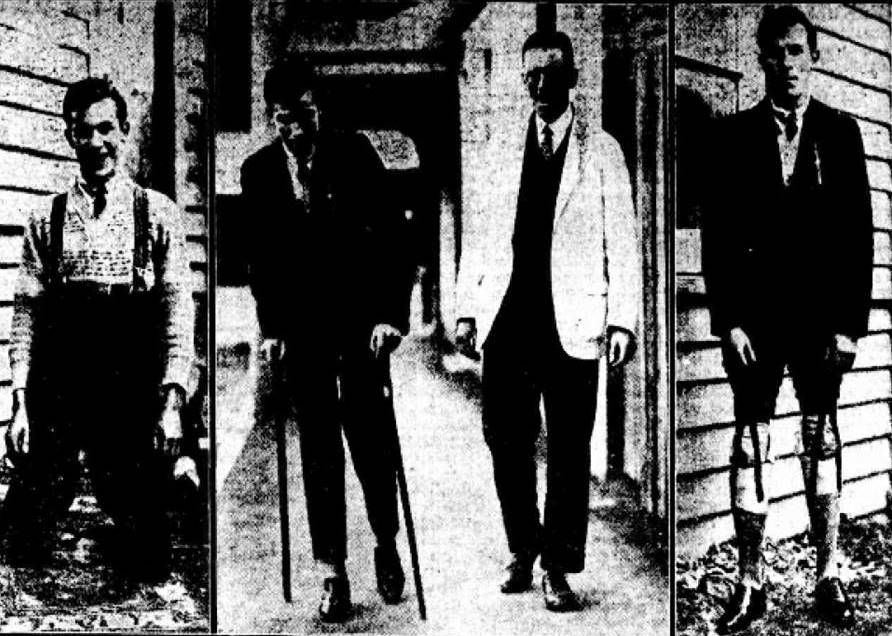
The other remarkable early ranger was Fergy who, like Lionel Connell, combined the job with that of tourism operator. His toughest journey was not on the lake but in an upside-down bath. While building the original Pine Valley Hut, the Lake St Clair ranger lugged an iron tub to it about 10 km from Narcissus Landing by balancing it upside down on his shoulders and head, his forehead reputedly having been reinforced to mend a war wound (his World War One record suggests only that he suffered from shell shock and deafness). Stripping off in the heat, his curses echoing inside the bath, he was stark naked when he ran into a party of bushwalkers. 

Extension of eastern and western reserve boundaries 1935 and 1939

The extension of fauna sanctuary boundaries to natural features was done with the intention of negating claims by hunters that they weren’t sure where the boundaries were. Tommy McCoy seems to have known. His Lake Ayr Hut was cheekily perched within sight of the reserve boundary. Reactions to it showed the distinction between the old-style conservationists in the park administration and the new ones of the bushwalking community. Cradle Mountain Reserve Board Secretary Ron Smith, a former possum shooter, respectfully left payment of threepence for a candle he removed from McCoy’s camp.[21] Hobart hikers, on the other hand, became conservation activists, puncturing McCoy’s canned food with a geological pick when they found his hut in 1948.[22] McCoy, like fellow snarers Paddy Hartnett, Bert Nichols and Lionel Connell before him, embraced the opportunities offered by tourism, building and repairing Overland Track huts. He was proprietor of Waldheim Chalet when he died in 1952.

Some of JW Beattie’s islands, southern end of Lake St Clair. Beattie photo, courtesy of Alma McKay.


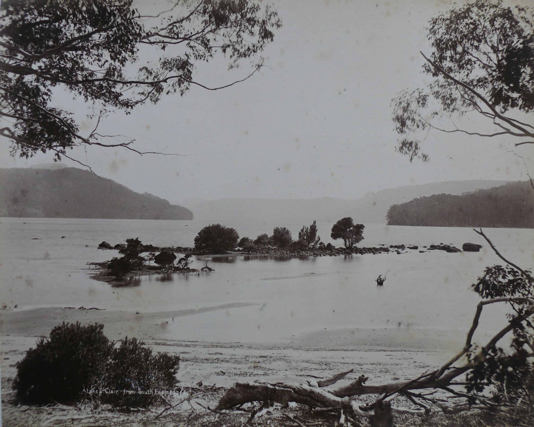
Damming Lake St Clair 1937

The Art Deco Pump-house Hotel which juts into southern Lake St Clair, as if walking the plank for its crimes, is a symbol of gradually changing values. In 1922, in a joint lecture about ‘preserving’ the tract of land south from Cradle Mountain, Ray McClinton and Fred Smithies deplored the ‘firestick of the destroyer’ and the ‘ravages of the trapper’ but spruiked the hydro-electric potential of the region’s lakes.[23] Fifteen years later the naivety of this position became apparent when the Hydro-Electric Department dammed the Derwent River as part of the Tarraleah Power Scheme. After assuring the National Park Board that Lake St Clair would be unaffected, it raised the lake’s water level by more than a metre, sinking the golden moraine sand (the Frankland Beaches) and the accompanying islands once painted by Piguenit and photographed by Beattie.[24] A fringe of dead trees around the lake’s edge now greeted visitors. When photographers Stephen Spurling III and Frank Hurley joined the National Park Board in attacking the Hydro, Minister for Lands and Works Major TH Davies sprang to the institution’s defence, describing the damage as ‘unavoidable’.[25] This was a taste of what was to come at Cataract Gorge, Lake Pedder, the Pieman River and the Lower Gordon River.

Excision of the Wolfram Mine

With rearmament taking place in Europe in 1938, the raised price of tungsten (wolfram), used for strengthening steel, prompted an application to reopen the (Mount Oakleigh) Wolfram Mine, which was then included in the Cradle Mountain Reserve. CMRB Secretary Ron Smith penned the board’s opposition to the proposal, stating that no payable lode was likely to be found and that a successful application would set a bad precedent in terms of mining the reserve.[26] The subsidiary board’s concerns were not heeded. In a forerunner to national park and/or Wilderness World Heritage Area excisions at Mount Field, the Hartz Mountains and Exit Cave, the mine was temporarily excised from the scenic reserve as the Mount Oakleigh Conservation Area.[27] No Tasmanian reserved land ever seemed inalienable after this.

First load of logs from Mount Kate, 1943, with (left to right) George, Bernard and Leo Stubbs. Ron Smith photo, courtesy of Charles Smith.


The Mount Kate sawmill dispute and dissolution of the CMRB

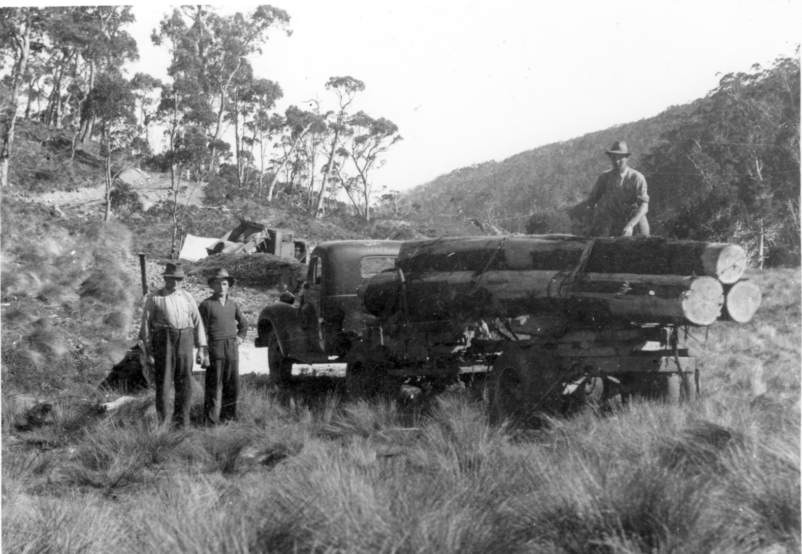
The pitfalls of having vested interests on a government board again became apparent in December 1943 when Ron Smith took advantage of wartime stringency, rising timber prices and a finished access road to start harvesting King Billy pine on his property at Mount Kate. Over the next few years the definition of conflict of interest and the limits of official jurisdiction became increasingly blurred, as private land was resumed at Cradle Valley and the problematic CMRB was dissolved. Ironically, Smith and the Launceston syndicate had previously offered their land to the government but been refused. With Waldheim compulsorily acquired, Lionel Connell resigned as ranger. His sons Esrom and Wal were later reemployed in their own right as rangers at Cradle Mountain and Lake St Clair. The appointment of the Cradle Mountain National Park Board in 1947 was the first step in placing the national park—as it was now known for the first time—on a sound footing, 25 years after the scenic reserves were initially gazetted. But the battle of ecology and economy continued.

[1] Gerard Castles, ‘Handcuffed volunteers: a history of the Scenery Preservation Board in Tasmania 1915–1971’, BA (Hons) thesis, University of Tasmania, Hobart, 1986.

[2] This was the Scenery Preservation Act (1921). For an example of fears of loggers being locked out of the Cradle Mountain and Lake St Clair Scenic Reserves, see E Alexander, ‘Cradle Mountain park: claims of timber area’, Advocate, 22 August 1921, p.5.

[3] ‘Fur farming: Cradle Mountain unsuitable: area further south chosen’, Mercury, 17 August 1925, p.6.

[4] ‘Lure of the skins’, Advocate, 22 August 1925, p.12.

[5] Statistics of Tasmania, 1922–23, p.58.

[6] Proclamation, Tasmanian Government Gazette, 8 March 1927, p.753.

[7] Proclamation, Tasmanian Government Gazette, 31 May 1927, pp.1412–13.

[8] Gerald Propsting to the secretary for Public Works, 4 August 1927, AA580/1/1 (TA); ‘Game Protection Act: illegal possession of skins’, Mercury, 17 August 1927, p.5.

[9] Fred Smithies, transcript of an interview by Margaret Bryant, 15 June 1977, NS573/3/3 (TA).

[10] Weekly Courier, 8 August 1928, p.1.

[11] Ron Smith to National Park Board Secretary Clive Lord, 27 August 1928, NS234/19/1/20 (TA).

[12] Paddy Hartnett to ET Emmett, 26 November 1928, PWD24/1/3; Director of Public Works to LM Shoobridge, Chairman of the National Parks Board, 13 March 1931, NS234/17/1/17 (TA).

[13] Bert Nichols to Ron Smith, 26 April 1931, NS573/1/1/4 (TA).

[14] Kevin Anderson, ‘Tasmania revisited: being the diary of Kevin Anderson, in which he related the incidents of his travelling to and through Tasmania with his companion, William Foo, from 12th April 1939 to the 26th April 1939’, unpublished manuscript (QVMAG), p.27.

[15] Jessie Luckman interviewed by Nic Haygarth.

[16] Bernard Stubbs interviewed by Nic Haygarth, c1993; Esrom Connell, in writing to Percy Mulligan, 20 September 1963 (NS234/19/122, TA), claimed to possess a diary in which Weindorfer recorded the failure of the motorbike to start. The present whereabouts of the diary are unknown. For the coronial inquiry into Weindorfer’s death, see AE313/1/1 (TA). The coroner determined the cause of death to be heart failure.

[17] ‘Papers relating to Coronial Enquiry into death of Gustav Weindorfer’, AE313/1/1 (TA).

[18] On 17 April 1928 Weindorfer wrote in his dairy, ‘This is very likely my last trip on the mountain’ (QVMAG). If he had a buyer for Waldheim then, the deal must have fallen through.

[19] Public Trustee to Fred Smithies, 11 November 1932, NS573/1/1/7 (TA).

[20] Minutes of the Cradle Mountain Reserve Board meeting, 26 April 1935, AF363/1/1, p.185 (TA).

[21] Ron Smith diary, 1940, NS234/16/1/41 (TA).

[22] Jessie Luckman interviewed by Nic Haygarth.

[23] ‘Cradle Mountain’, Advocate, 31 July 1922, p.2.

[24] ‘Level of water raised’, Mercury, 12 October 1938, p.13.

[25] National Park Board: ‘Level of water raised’, Mercury, 12 October 1938, p.13; Davies: ‘Lake St Clair: high level “unavoidable”’, Advocate, 13 October 1938, p.6; Hurley: ‘Tasmanians asleep’, Mercury, 30 January 1939, p.8; Spurling: S Spurling, ‘Scenic vandalism’, Examiner, 5 October 1940, p.3.

[26] Ron Smith to Minister for Mines, 3 May 1938, NS234/19/1/4 (TA).

[27] For an overview of the Wolfram Mine dispute, see Gerard Castles, ‘Handcuffed volunteers: a history of the Scenery Preservation Board in Tasmania 1915–1971’, pp.51–52.

Posted on 2 Comments

Lily Gresson’s Adamsfield Airbnb

Main Street Adamsfield, 1926, with Ida Smithies and Florence Perrin. Fred Smithies photo courtesy of the Tasmanian Archive and Heritage Office.


In November 1926 a Mrs Gresson advertised tourist accommodation at the Tasmanian mining settlement of Adamsfield: ‘See Tasmania’s Wild West, the “osie” diggers, Adams Falls, Gordon Gorge’.[1] What extraordinary enterprise for a simple digger’s wife 120 km west of Hobart! However, when you learn what an extraordinary woman Lily Gresson actually was, this visionary behaviour comes as no surprise at all.

A water race and the village of Adamsfield, 1926, Fred Smithies photo courtesy of the Tasmanian Archive and Heritage Office.

Her old school Airbnb advert was probably shaped by two events: meeting the one-man promotional band Fred Smithies; and a memorable outing she made to the nearby Gordon River Gorge. Visiting Adamsfield by horseback and pack-horse in February and March 1926, Smithies, an amateur tourism promoter, had snapped the town and its jagged skyline for his travelling lantern-slide lecture ‘A trip through the wilds of the west coast and the osmiridium fields’. ‘Gorges of inspiring grandeur’ and ‘magnificent mountain scenes’ also transfixed Gresson. Decades later she recalled that

‘the scenery to the Gordon River was indescribable. Peak after peak of snow-capped mountains and the Gordon Gorge was so precipitous we would scarcely see the bottom … [it] … was like so many battlements’.

Her party ‘cheerfully stalked along the ten miles of wonderful scenery singing bits of popular songs. This was the first time I had heard [‘]Waltzing Matilda[’], she recalled, ‘and it certainly cheered and helped us along, and home again, when we’—Lily and her husband Arthur Gresson, a veteran of the Siege of Mafeking during the South African War— ‘were beginning to flag’.[2]


Certainly the outing would have come as welcome relief from the routine of life on the Adamsfield diggings. The Gressons had rushed to Adams River in the spring of 1925, after the Staceys from the Tasman Peninsula and their mates struck payable osmiridium. Lily was a woman of great conviction. At a time when few women dared venture among the thousand or so men on the ossie field, she secured her own miner’s right, put together a side of bacon and other requisites, bundled her twelve-year-old son Wrixon onto the train and off they went to Fitzgerald, the western terminus of the Derwent Valley Line, to join Arthur.

Fitzgerald was still 42 km from Adamsfield. Meeting his family there, Arthur hired five horses, including one for Wrixon, who had never ridden a horse before, one for the packer and another to carry the three months’ supply of food and equipment. It was snowing. In parts of the Florentine Valley the mud was up to the horses’ girths, Lily recalled,

‘and they slithered, slipped and plunged into the side track to keep themselves steady. The track was narrow, hastily prepared in very thick scrub, corduroyed also hurriedly—the edges not even adzed. I pitied the poor ‘gees’ [horses] slipping and floundering to try and gain firm footing. I thought I would soon be slipping over their heads and called out to my husband, “Shall I dismount?” “Certainly not”, was the reply, “or you will never get up again.” So I stayed on as best I could following the packer’s lead, for I was behind him. Presently, just around the corner, he shouted, “Look out, the down packs are coming!”’[3]

A packer leading a pack-horse team out of Fitzgerald, taking supplies into Adamsfield, 1925. Alf Clark photo courtesy of Don Clark.

This was pack horses returning unsupervised from Adamsfield. When the osmiridium field was reached, the horses were simply released to find their own way back down the track to Fitzgerald. Given that there was no feed between the two centres, the hungry animals galloped wherever they could, a nasty surprise for the uninitiated coming the other way. How the horses survived the return trip without a broken leg is hard to imagine.

The Gresson party stopped for the night at Chrisp’s Hut, a leftover from the 1907 Great Western Railway Survey.[4] It took a further day to reach Adamsfield over the ranges. The mining settlement was ‘a busy seething mass of men and horses, to say nothing of a vast morass of mud, with short stumps sticking up everywhere, quite enough to topple us over’. Arthur Gresson was living in the sort of tent-hut typical of a temporary miner’s quarters. Wrixon slept on a bench in a bark humpy with only a hessian curtain to keep out the cold, while his parents bunked down under a tent fly.

Having obtained the miner’s right, Lily was entitled to peg her own claim measuring 50 yards by 50 years (that is, about 45 metres square), and she set out next morning suitably attired in her lace-up mining boots, riding breeches, short coat and emerald-green rain hat. After she had dug a hole almost two metres deep and obtaining osmiridium-bearing earth, a man ‘jumped’ her claim, taking all the valuable ‘wash’ before she even knew it had happened. Arthur Gresson sent the intruder packing, but the damage was done, and Lily had to start again on a new claim. Soon she was winning tiny nuggets of coarse ‘metal’ by sluicing the ‘wash-dirt’.[5]

The Gressons remained at Adamsfield through the tough winter of 1926, when the diggers tried to counteract a reduced osmiridium price by selling their metal directly to London. It was tough going through that winter. Many left the field, while others stayed and suffered. Lily recalled the time nineteen-year-old digger Maxwell Godfrey went missing on an icy-cold night. He curled up under a log in the bush, but his legs were frostbitten. Nurse Elsie Bessell, who had only a tent for a hospital, could do little for him, and the news got no better after he was stretchered out to Fitzgerald, slung between two horses. Both his legs were amputated below the knee.[6] A public subscription raised about £500 to help him, and soon he was walking again with the aid of prosthetics.[7]

Maxwell Godfrey walks again, from the Mercury, 24 May 1928, p.5.

Lily Gresson, who had had some nursing experience in London, again showed her versatility by looking after the two patients in the hospital while Nurse Bessell accompanied the incapacitated man out to the railway station. Perhaps Lily also home schooled thirteen-year-old Wrixon. There were few children and no school at Adamsfield at this time, so otherwise he would have lost a year of his education.

And the Gressons’ Air B’n’B house? Well, while it was hardly the Adamsfield Hilton, it was comfortable enough by mining frontier standards—a paling hut with a big fireplace and a real glass window.[8] Lily Gresson might have been just a little ahead of her time. Hikers would soon be on their way to Adamsfield and the glorious south-west beyond. Ernie Bond would be besieged with them at times on his Gordon River farm, Gordon Vale, during the 1930s and 1940s. In 1952 the Launceston and Hobart Walking Clubs would even inherit Gordon Vale. Lily Gresson , pioneer of the Adamsfield diggings, was onto something!

With thanks to Dale Matheson, who showed me this story.

[1] ‘Board and residence’, Mercury, 23 November 1926, p.1.

[2] Lily Gresson; quoted by Fred A Murfet, in Sherwood reflections, the author, 1987, p.194.

[3] Lily Gresson; quoted by Fred A Murfet, in Sherwood reflections, p.190.

[4] In her account, Lily Gresson did not mention the notorious ‘Digger’s Delight’, the sly-grog shop and accommodation house that accompanied Chrisp’s Hut soon after the Adams River rush began. Perhaps Ralph Langdon and Bernie Symmons had already moved on into down-town Adamsfield, building Symmons Hall with its accompanying illegal boozer.

[5] Lily Gresson; quoted by Fred A Murfet, in Sherwood reflections, p.192.

[6] ‘Bush nursing’, Mercury, 22 July 1926, p.11; Elsie G Bessell, quoted by Marita Bardenhagen, Adamsfield bush nursing paper, presented at the Australian Mining History Association conference at Queenstown, 2008; ‘Sufferer in bush’, Mercury, 24 May 1928, p.5.

[7] ‘Maxwell Godfrey Fund’, Mercury, 27 July 1927, p.3; ‘Maxwell Godfrey walks again’, and ‘Sufferer in bush’; both Mercury, 24 May 1928, p.5.

[8] Lily Gresson; quoted by Fred A Murfet, in Sherwood reflections, p.192.

Posted on 2 Comments

To Lake St Clair with car and camera

Starting out from the Ouse River in the Hupmobile, 1914-15 trip. Ray McClinton photo from the Weekly Courier, 28 January 1915, p.18.

It was the first motor trip to Lake St Clair. In 1915 pioneering motor tourers Ray and Edith McClinton mounted a two-week expedition from Launceston to the highland lake, with ‘Nina’, social pages and women’s editor of the Weekly Courier newspaper, as their guest. The Hupmobile party, towing an additional 120 kg of motor boat engine and luggage, battled rocks, ruts, rain and button grass up the Derwent Valley, breaking their trip at Ouse, the Ellises’ house near the Dee River, Weeding’s at Marlborough and Pearce’s at the Clarence River.[1]

McClinton, a San Francisco dentist who with his wife lived in Launceston 1904–28, would soon become one of Tasmania’s great tourism ‘boosters’.[2] Like fellow Launceston rev-heads Stephen Spurling III, Fred Smithies and HJ King, McClinton worshipped both nature and technology. He wanted to crash deep into the highlands, breaking down the physical and virtual isolation with carburettors and cameras. He was also imbued with fervour for worthy objects and the nineteenth-century tradition of public education that made him a consummate lantern slide lecturer on anything from x-raying teeth to colour photography.[3] Soon he would turn those skills to promoting Tasmania’s scenic wonders. Visiting Lake St Clair was one of the foundation stones of his eventual campaign in support of plans for a Cradle Mountain-Lake St Clair national park.[4]

The Hup party at the government log cabin, Cynthia Bay, Lake St Clair, 1914-15 trip, with the unmistakable figure of Paddy Hartnett closest to the camera. Ray McClinton photo from the Weekly Courier, 28 January 1915, p.18.

The motorboat and Paddy Hartnett in the lake, 1914-15 trip. Ray McClinton photo from the Weekly Courier, 28 January 1915, p.18.

Already there was rudimentary infrastructure at the lake. The Hup party took advantage of the government-built three-room log cabin at Cynthia Bay. On foot at last they crossed the Cuvier River on a rustic bridge. McClinton attached his engine to the boat at the lake, enabling communication with the Perrin party —a pedestrian party—camped near the Narcissus at the northern end of the lake. Highland guide Paddy Hartnett had led them to Lake St Clair via the Mersey River.[5] ‘Nina’ marvelled at the reflections in the Narcissus River and the gambolling of a platypus. She made even the ‘perfume of petrol’ mingle poetically with the ‘sweet scent of the woods’, as the first propeller churned the waters of Lake St Clair. A storm disrupted the return journey down the lake but, with the aid of axe, saw, lamp and candles, McClinton soon fashioned ‘Nina’ a comfortable bower in the forest:

‘Imagine myrtle trees towering over a hundred feet high, and their branches interlaced, so that only patches of sky could be seen above, and only glimpses of the lake between. Then picture tree-ferns all around, and green moss for a carpet. Add to his a vision of remnants of fallen trees of age untold, coated with moss inches thick, like green plush. The imagine crystal streams trickling down the mountain side … The whole scene was fairyland …’[6]

But who was ‘Nina’? She was an outstanding journalist called Kate Farrell, better known by her pseudonyms ‘Nina’ and ‘Sylvia’. Her literary career spanned 33 years and included both Launceston dailies, the Daily Telegraph and the Examiner, plus their respective weekend newspapers, the Colonist and the Weekly Courier.[7] The scale of her anonymity can be tested quite easily by searching the Trove digital database: during her literary career c1894–1927 the name Kate Farrell has only 7 hits, while ‘Woman’s World’ by ‘Sylvia’ occurs 1933 times.[8] ‘Woman’s World’ was generally frocks, recipes and home hints. In 1914 Farrell published her 96-page Sylvia’s cookery book.[9] During World War One she turned her attention to bringing comfort to those at the front, and she was also a ‘booster’, penning tourist guide The charm of the north in 1922.[10] Farrell had been motor touring with the McClintons for years, having accompanied them to Lake Sorell in their Winton Four and on Edith McClinton’s one-woman non-stop run from Launceston to Richmond in the Hupmobile. [11] Farrell preceded Ray McClinton as a tourism ‘booster’, and at Lake St Clair she quickly got into her stride:

‘The beauty of the scene is inexpressible. One can imagine the crowds of tourists who would visit Lake St Clair if the road were made. A number of small chalets built, with a caretaker in charge, and a motor boat available for the use of visitors, would help matters along considerably. I hope it will not be long before such dreams come true’.[12]

Stuck in a wash-out near Ellendale, 1916-17 trip, King and McClinton in action. HJ King photo courtesy of Daisy Glennie.

The Hupmobile, containing the two ladies, and McClinton in the ‘Baby Grand’ Chevrolet, posed as if tackling the corded track, 1916-17 trip. HJ King photo courtesy of Maggie Humphrey.

‘The darkroom at Lake St Clair’, HJ King despairs over the photographic facilities, 1916-17 trip. HJ King photo courtesy of Maggie Humphrey.


The 1916-17 party at Bushy Park, Sir Philip Fysh with the white beard, the McClintons at centre, with Kate Farrell fourth from left. Bushwalker and park administrator WJ Savigny is second from left. HJ King photo courtesy of Maggie Humphrey.

The McClintons and Farrell repeated their Lake St Clair excursion two years later, this time with the established amateur photographer HJ King. While King drove McClinton’s faithful old Hupmobile (registration number 586), the dentist was at the helm of his new ‘Baby Grand’ Chevrolet (number 4465). Both vehicles survived—but, in the true tradition of motor touring, it was a near thing for much of the way. The government accommodation house had been destroyed by fire in the intervening two years. However, rather than repeat herself, Farrell minimised her tourism boosting and concentrated on describing the route taken and the social pleasantries of a visit to former premier Sir Philip Fysh’s Bushy Park estate.[13] The real reporter was King. McClinton deferred to the superior shutterbug, allowing him to be the official tour photographer, and many King photos from this trip appeared in the Weekly Courier during 1917, including his light-hearted ‘Lake St Clair Darkroom’.[14] King’s keen eye captured the logistical difficulties of the corrugated track, with block and tackle deployed near Ellendale, some pick and shovel work on the Sandhill at Lawrenny and rescue by a bullock team near Derwent Bridge. McClinton also appears to have had a long stint with a hand saw clearing a fallen tree. One of the most interesting images from the trip was McClinton, the ex-patriate American, recalling his military training by posing with a gun upon his shoulder, as if guarding the beauty of Lake St Clair.[15] How far they were from the European War (King was a conscientious objector, McClinton effectively neutral), yet the connection remained even here.[16]

Ray McClinton posed militarily in front of Mount Ida, 1916-17. HJ King photo courtesy of Maggie Humphrey.

‘To Lake St Clair with car and camera’ became one of first outings of the McClinton–King lantern lecturing team.[17] Later, with Fred Smithies, they would add Cradle Mountain and the Pelion region to their lecturing repertoire. At her retirement in 1927 Kate Farrell was ‘Launceston’s senior press woman’ and the last of the Weekly Courier’s original staff. [18] The McClintons were there to farewell her, just ahead of their departure from Tasmania.[19] Farrell died in 1933, after a long battle with illness, leaving only King to enjoy the road they had craved, the ‘missing link’—forerunner of the Lyell Highway—between Marlborough and Queenstown.[20] By then Lake St Clair was well on its way to becoming a tourism hub.

[1] See ‘Nina’ (Kate Farrell), ‘A trip to Lake St Clair’, Weekly Courier, 21 January 1915, p.29; 28 January 1915, pp.27–28; 4 February 1915, pp.28 and 29; and 11 February 1915, p.28.

[2] Edith McClinton actually left Tasmania for Honolulu in June 1927 (‘Social notes’, Daily Telegraph, 22 June 1927, p.2), Ray MClinton joining her there in November 1928 (‘Dr Ray McClinton’, Mercury, 8 November 1928, p.11).

[3] See, for example, ‘X-rays and the teeth’, Examiner, 18 June 1925, p.5.; and ‘Local and general’, Daily Telegraph, 5 July 1923, p.4. For Launceston rev-head photographers generally, see Nic Haygarth, The wild ride: revolutions that shaped Tasmanian black and white wilderness photography, National Trust of Australia (Tasmania), Launceston, 2008.

[4] McClinton and Smithies had visited the Du Can Range area in 1913, and may have visited Lake St Clair at that time, but that was a pedestrian trip.

[5] See ‘The adventures of Paddy’s Gang: an account of a Perrin family trip to Lake St Clair guided by Hartnett over the Christmas–New Year period in 1914–1915’, diary in possession of Bessie Flood.

[6] ‘Nina’ (Kate Farrell), ‘A trip to Lake St Clair’, Weekly Courier, 28 January 1915, p.28.

[7] ‘Miss K Farrell’s death’, Examiner, 4 July 1933, p.9. Thanks to Ross Smith for identifying ‘Nina’.

[8] The Weekly Courier is not yet indexed on Trove, making it impossible to search on ‘Social notes’ by ‘Nina’. Propriety of the time contributed to this disparity, insisting that she be referred to simply as ‘Miss Farrell’ throughout her life.

[9] ‘Social notes’, Daily Telegraph, 25 May 1927, p.2. The full details are K Farrell, Sylvia’s cookery book: tested recipes and items of interest, Launceston, 1914.

[10] K Farrell, The charm of the north, Launceston City Council, Launceston, 1922.

[11] ‘Nina’ (Kate Farrell), ‘Camping at Interlaken’, Weekly Courier, 21 January 1909, p.29; ‘Exhaust’, ‘Motor notes’, Daily Telegraph, 9 November 1911, p.11.

[12] ‘Nina’ (Kate Farrell), ‘A trip to Lake St Clair’, Weekly Courier, 11 February 1915, p.28.

[13] ‘Nina’ (Kate Farrell), ‘A trip to Lake St Clair’, Weekly Courier, 11 January 1917, p.27. The trip was also written up by ‘Spark’ (Charles George Saul), ‘Motoring’, Examiner, 13 January 1917, p.4. Thanks to Ken Young for identifying ‘Spark’.

[14] See Weekly Courier, 11 January 1917, p.17; 18 January 1917, p.18; 25 January 1917, p.17; 1 February 1917, p.17; 15 February 1917, p.17; 22 March 1917, p.20; 5 April, pp.17, 20 and 21; 31 May, p.21; 13 September, p.17; 18 October 1917, p.17; and 1 November 1917 (Christmas issue), p.22.

[15] Ray McClinton performed military training 1900–02 in California, film no.981549, MF4:2, National Guard Registers v.61, 1st Infantry, 2nd Brigade, Enlisted Men, 1883–1902, California, Military Registers, 1858–1923.

[16] McClinton supported the Allied war effort, but America did not enter World War One until April 1917.

[17] See ‘Spark’ (Charles George Saul), ‘Motoring’, Examiner, 3 February 1917, p.4; ‘Plug’, ‘Motor notes’, Daily Telegraph, 13 February 1917, p.6.

[18] ‘Journalist honoured’, Examiner, 24 May 1927, p.7, ‘Social notes’, Daily Telegraph, 25 May 1927, p.2.

[19] The McClintons’ names were accidentally omitted from the Examiner’s story of this event. See the correction, Examiner, 25 May 1927, p.7.

[20] ‘Miss K Farrell’s death’, Examiner, 4 July 1933, p.9.